North Okanagan | |
|---|---|
| Regional District of North Okanagan | |
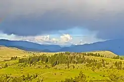 Rainbow over Lumby | |
 Location in British Columbia | |
| Country | Canada |
| Province | British Columbia |
| Administrative office location | Coldstream |
| Government | |
| • Type | Regional district |
| • Body | Board of Directors |
| • Chair | Kevin Acton (Lumby) |
| • Vice Chair | Amanda Shatzko (C) |
| • Electoral Areas |
|
| Area | |
| • Land | 7,502.60 km2 (2,896.77 sq mi) |
| Population (2016)[2] | |
| • Total | 84,354 |
| • Density | 11.2/km2 (29/sq mi) |
| Website | www |
The Regional District of North Okanagan (RDNO) is a regional district in the Canadian province of British Columbia, Canada. The Canada 2011 Census population was 81,237. The land area is 7,512.58 km² (2,900.62 sq mi). The regional district's head office is in the district municipality of Coldstream, although the largest population centre is its immediate neighbour, the city of Vernon.
Demographics
As a census division in the 2021 Census of Population conducted by Statistics Canada, the Regional District of North Okanagan had a population of 91,610 living in 38,821 of its 42,722 total private dwellings, a change of 8.6% from its 2016 population of 84,344. With a land area of 7,497.23 km2 (2,894.70 sq mi), it had a population density of 12.2/km2 (31.6/sq mi) in 2021.[3]
| Panethnic group |
2021[4] | 2016[5] | 2011[6] | 2006[7] | 2001[8] | |||||
|---|---|---|---|---|---|---|---|---|---|---|
| Pop. | % | Pop. | % | Pop. | % | Pop. | % | Pop. | % | |
| European[lower-alpha 1] | 77,375 | 86.44% | 72,615 | 88.07% | 70,785 | 89.41% | 68,820 | 90.33% | 66,360 | 91.7% |
| Indigenous | 7,100 | 7.93% | 6,350 | 7.7% | 6,030 | 7.62% | 4,905 | 6.44% | 3,505 | 4.84% |
| South Asian | 1,390 | 1.55% | 900 | 1.09% | 540 | 0.68% | 835 | 1.1% | 1,135 | 1.57% |
| East Asian[lower-alpha 2] | 1,375 | 1.54% | 1,255 | 1.52% | 870 | 1.1% | 915 | 1.2% | 905 | 1.25% |
| Southeast Asian[lower-alpha 3] | 1,075 | 1.2% | 690 | 0.84% | 325 | 0.41% | 195 | 0.26% | 180 | 0.25% |
| African | 470 | 0.53% | 205 | 0.25% | 175 | 0.22% | 165 | 0.22% | 80 | 0.11% |
| Latin American | 295 | 0.33% | 205 | 0.25% | 170 | 0.21% | 150 | 0.2% | 70 | 0.1% |
| Middle Eastern[lower-alpha 4] | 225 | 0.25% | 140 | 0.17% | 105 | 0.13% | 95 | 0.12% | 40 | 0.06% |
| Other[lower-alpha 5] | 200 | 0.22% | 105 | 0.13% | 165 | 0.21% | 115 | 0.15% | 80 | 0.11% |
| Total responses | 89,510 | 97.71% | 82,455 | 97.75% | 79,165 | 97.45% | 76,190 | 98.56% | 72,370 | 98.83% |
| Total population [lower-alpha 6] | 91,610 | 100% | 84,354 | 100% | 81,237 | 100% | 77,301 | 100% | 73,227 | 100% |
Subdivisions
Cities
District municipalities
- Coldstream - 10,314
- Spallumcheen - 5,055
Village
- Lumby - 2,000
Regional district electoral areas
- North Okanagan B
- North Okanagan C
- North Okanagan D
- North Okanagan E
- North Okanagan F
Indian reserves NB These are excluded from governance by the regional district and have their own governments (the Spallumcheen Indian Band and the Okanagan Indian Band).
- Enderby Indian Reserve No. 2
- Harris Indian Reserve No. 3
- Okanagan Indian Reserve No. 1 (only partly within the RD)
- Priest's Valley Indian Reserve No. 6
Notes
- ↑ Statistic includes all persons that did not make up part of a visible minority or an indigenous identity.
- ↑ Statistic includes total responses of "Chinese", "Korean", and "Japanese" under visible minority section on census.
- ↑ Statistic includes total responses of "Filipino" and "Southeast Asian" under visible minority section on census.
- ↑ Statistic includes total responses of "West Asian" and "Arab" under visible minority section on census.
- ↑ Statistic includes total responses of "Visible minority, n.i.e." and "Multiple visible minorities" under visible minority section on census.
- ↑ Totals greater than 100% due to multiple origin responses.
References
- ↑ "Board of Directors". Retrieved July 9, 2019.
- ↑
- ↑ "Population and dwelling counts: Canada and census divisions". Statistics Canada. February 9, 2022. Retrieved April 3, 2022.
- ↑ Government of Canada, Statistics Canada (October 26, 2022). "Census Profile, 2021 Census of Population". www12.statcan.gc.ca. Retrieved February 19, 2023.
- ↑ Government of Canada, Statistics Canada (October 27, 2021). "Census Profile, 2016 Census". www12.statcan.gc.ca. Retrieved February 19, 2023.
- ↑ Government of Canada, Statistics Canada (November 27, 2015). "NHS Profile". www12.statcan.gc.ca. Retrieved February 19, 2023.
- ↑ Government of Canada, Statistics Canada (August 20, 2019). "2006 Community Profiles". www12.statcan.gc.ca. Retrieved February 19, 2023.
- ↑ Government of Canada, Statistics Canada (July 2, 2019). "2001 Community Profiles". www12.statcan.gc.ca. Retrieved February 19, 2023.
External links


Places adjacent to Regional District of North Okanagan | |
|---|---|


Subdivisions of British Columbia | |
|---|---|
| Subdivisions | |
| Communities | |
| Metro areas and agglomerations | |
| Regional districts |
|
| |