Riacho Fundo | |
|---|---|
| Região Administrativa de Riacho Fundo Administrative Region of Riacho Fundo | |
.svg.png.webp) Flag | |
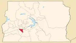 Location of Riacho Fundo in the Federal District | |
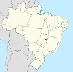
 Riacho Fundo Location of Riacho Fundo in Brazil | |
| Coordinates: 15°53′00″S 48°01′03″W / 15.88333°S 48.01750°W | |
| Country | Brazil |
| Region | Central-West |
| State | Federal District |
| Founded | January 13, 1993 |
| Government | |
| • Regional administrator | Heitor Mitsuaki Kanegae[1] |
| Area | |
| • Total | 56.02 km2 (21.63 sq mi) |
| Population (2013)[2] | |
| • Total | 37,278 |
| • Density | 670/km2 (1,700/sq mi) |
| Time zone | UTC−3 (BRT) |
| Postal Code (CEP) | 71800-000 |
| Area code | +55 61 |
| Website | www |
Riacho Fundo is an administrative region in the Federal District in Brazil.
See also
References
- ↑ "Perfil do administrador – Administração Regional de Riacho Fundo". Archived from the original on 2017-07-08. Retrieved 2017-07-07.
- ↑ "Pesquisa Distrital por Amostra de Domicílios - 2010/2011" (PDF) (in Portuguese). Codeplan. Retrieved 2013-04-09.
External links
Wikimedia Commons has media related to Riacho Fundo.
This article is issued from Wikipedia. The text is licensed under Creative Commons - Attribution - Sharealike. Additional terms may apply for the media files.