Rietmolen | |
|---|---|
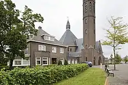 Church of Rietmolen | |
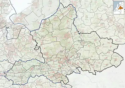 Rietmolen Location in the province of Gelderland  Rietmolen Rietmolen (Netherlands) | |
| Coordinates: 52°5′14″N 6°27′28″E / 52.08722°N 6.45778°E | |
| Country | Netherlands |
| Province | Gelderland |
| Municipality | Berkelland |
| Area | |
| • Total | 12.24 km2 (4.73 sq mi) |
| Elevation | 19 m (62 ft) |
| Population (2021)[1] | |
| • Total | 1,020 |
| • Density | 83/km2 (220/sq mi) |
| Time zone | UTC+1 (CET) |
| • Summer (DST) | UTC+2 (CEST) |
| Postal code | 7165[1] |
| Dialing code | 0545 |
Rietmolen is a village in the eastern Netherlands. It is located in the municipality of Berkelland, Gelderland.
It was first mentioned in the 1630s as Rytmuelerbrugh, and means "windmill along a stream".[3] Since 1712, the inn Reetmölle was used as a Catholic church. In 1835, a real church was built.[4] In 1931, construction began on a new church. It was finished in 1933, and has a 45 metres (148 ft) tall slender tower which resembles a minaret.[5]
Gallery
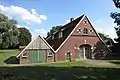 Farm in Rietmolen
_-_Waterleidingdijk%252C_Rietmolen.jpg.webp) Bus stop
Bus stop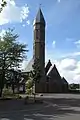 Tower of the church
References
- 1 2 3 "Kerncijfers wijken en buurten 2021". Central Bureau of Statistics. Retrieved 20 March 2022.
Two entries. Rural population is combined with Broeke
- ↑ "Postcodetool for 7165AA". Actueel Hoogtebestand Nederland (in Dutch). Het Waterschapshuis. Retrieved 20 March 2022.
- ↑ "Rietmolen - (geografische naam)". Etymologiebank (in Dutch). Retrieved 20 March 2022.
- ↑ "Rietmolen". Plaatsengids (in Dutch). Retrieved 20 March 2022.
- ↑ "Over ons". Paulus Ludger (in Dutch). Retrieved 20 March 2022.
Wikimedia Commons has media related to Rietmolen.
This article is issued from Wikipedia. The text is licensed under Creative Commons - Attribution - Sharealike. Additional terms may apply for the media files.