| Ash | |
|---|---|
 | |
| Location | |
| Country | United Kingdom |
| Physical characteristics | |
| Source | |
| • location | Nr. Brent Pelham, Hertfordshire |
| • elevation | 115 m (377 ft) |
| Mouth | |
• location | Stanstead Abbotts, Hertfordshire into River Lea |
• coordinates | 51°47′56″N 0°0′16.5″W / 51.79889°N 0.004583°W |
| Length | 26 km (16 mi) |
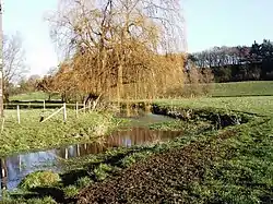
The River Ash originates near the village of Brent Pelham in North Hertfordshire and flows through The Hadhams (Little, Ford and Much), Widford, Wareside, until it reaches the River Lea near Stanstead Abbots.[1]
References
- ↑ Lydekker, R. (1909). Hertfordshire. Cambridge University Press. p. 23.

Wikimedia Commons has media related to River Ash.
This article is issued from Wikipedia. The text is licensed under Creative Commons - Attribution - Sharealike. Additional terms may apply for the media files.