Rosetta
eLuzethe | |
|---|---|
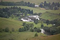 Mooi River Falls near Rosetta | |
 Rosetta  Rosetta | |
| Coordinates: 29°18′22″S 29°58′41″E / 29.306°S 29.978°E | |
| Country | South Africa |
| Province | KwaZulu-Natal |
| District | uMgungundlovu |
| Municipality | Mpofana |
| Area | |
| • Total | 13.47 km2 (5.20 sq mi) |
| Population (2011)[1] | |
| • Total | 557 |
| • Density | 41/km2 (110/sq mi) |
| Racial makeup (2011) | |
| • Black African | 64.6% |
| • Indian/Asian | 1.6% |
| • White | 32.9% |
| • Other | 0.9% |
| First languages (2011) | |
| • Zulu | 59.5% |
| • English | 33.6% |
| • Afrikaans | 4.1% |
| • Other | 2.7% |
| Time zone | UTC+2 (SAST) |
| PO box | 3301 |
| Area code | 033 |
Rosetta is a village in Mpofana Local Municipality in the KwaZulu-Natal province of South Africa.
Rosetta is known for the case of Elizabeth Klarer, who in 1955 claimed to have been abducted by aliens on a hill outside the town.[2]
References
- 1 2 3 4 "Main Place Rosetta". Census 2011.
- ↑ B J Booth (12 July 2012). UFOs Caught on Film: Amazing Evidence of Alien Visitors to Earth. David & Charles. p. 41. ISBN 1-4463-5587-X.
Municipalities and communities of uMgungundlovu District Municipality, KwaZulu-Natal | ||
|---|---|---|
District seat: Pietermaritzburg | ||
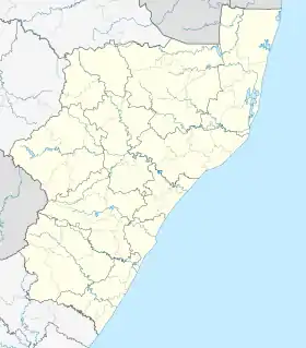
| uMshwathi | .svg.png.webp) uMgungundlovu District within South Africa | |
| uMngeni | ||
| Mpofana | ||
| Impendle | ||
| Msunduzi | ||
| Mkhambathini | ||
| Richmond | ||
This article is issued from Wikipedia. The text is licensed under Creative Commons - Attribution - Sharealike. Additional terms may apply for the media files.