Royal Heights | |
|---|---|
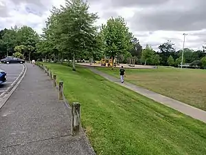 Moire Park in Royal Heights | |
| Coordinates: 36°49′44″S 174°37′48″E / 36.829°S 174.630°E | |
| Country | New Zealand |
| City | Auckland |
| Local authority | Auckland Council |
| Electoral ward | Waitākere ward |
| Local board | Henderson-Massey |
| Area | |
| • Land | 263 ha (650 acres) |
| Population (June 2022)[2] | |
| • Total | 7,940 |
| Westgate | West Harbour | Hobsonville |
| Massey |
  Royal Heights Royal Heights  |
(Waitematā Harbour) |
| Massey | Lincoln | Te Atatū Peninsula |
Royal Heights is a suburb in West Auckland, under the local governance of Auckland Council. Moire Park is a large park in Royal Heights, which has both sports grounds and areas of bush with walking tracks.[3][4] The Manutewhau Walkway in Moire Park follows the Manutewhau Stream.[5]
Demographics
Royal Heights covers 2.63 km2 (1.02 sq mi)[1] and had an estimated population of 7,940 as of June 2022,[2] with a population density of 3,019 people per km2.
| Year | Pop. | ±% p.a. |
|---|---|---|
| 2006 | 6,465 | — |
| 2013 | 6,768 | +0.66% |
| 2018 | 7,278 | +1.46% |
| Source: [6] | ||
Royal Heights had a population of 7,278 at the 2018 New Zealand census, an increase of 510 people (7.5%) since the 2013 census, and an increase of 813 people (12.6%) since the 2006 census. There were 2,160 households, comprising 3,597 males and 3,678 females, giving a sex ratio of 0.98 males per female, with 1,635 people (22.5%) aged under 15 years, 1,734 (23.8%) aged 15 to 29, 3,168 (43.5%) aged 30 to 64, and 738 (10.1%) aged 65 or older.
Ethnicities were 54.1% European/Pākehā, 17.5% Māori, 21.8% Pacific peoples, 21.2% Asian, and 4.5% other ethnicities. People may identify with more than one ethnicity.
The percentage of people born overseas was 34.5, compared with 27.1% nationally.
Although some people chose not to answer the census's question about religious affiliation, 43.0% had no religion, 41.1% were Christian, 1.1% had Māori religious beliefs, 2.4% were Hindu, 3.0% were Muslim, 1.4% were Buddhist and 1.6% had other religions.
Of those at least 15 years old, 1,140 (20.2%) people had a bachelor's or higher degree, and 939 (16.6%) people had no formal qualifications. 846 people (15.0%) earned over $70,000 compared to 17.2% nationally. The employment status of those at least 15 was that 3,009 (53.3%) people were employed full-time, 714 (12.7%) were part-time, and 288 (5.1%) were unemployed.[6]
| Name | Area (km2) | Population | Density (per km2) | Households | Median age | Median income |
|---|---|---|---|---|---|---|
| Royal Heights North | 1.50 | 3,501 | 2,334 | 1,095 | 33.2 years | $35,800[7] |
| Royal Heights South | 1.13 | 3,777 | 3,342 | 1,065 | 31.2 years | $29,100[8] |
| New Zealand | 37.4 years | $31,800 |
Education
Colwill School is a coeducational full primary school (years 1–8), with a roll of 217 students as of April 2023.[9][10]
Amenities
The Manutewhau Walk Reserve is an area of native bush reserve found in West Harbour, along the banks of the Manutewhau Stream. The reserve is adjacent to Moire Park, a large public park and sportsfield.[11]
Gallery
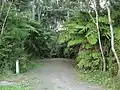 Entrance to Manutewhau Walkway in Moire Park
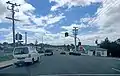 Intersection of Royal Road and Moire Road in Royal Heights
Notes
- 1 2 "ArcGIS Web Application". statsnz.maps.arcgis.com. Retrieved 20 June 2022.
- 1 2 "Population estimate tables - NZ.Stat". Statistics New Zealand. Retrieved 25 October 2022.
- ↑ "Moire Park". Places New Zealand. Retrieved 25 June 2020.
- ↑ "Moire Park Path". Auckland Council. Retrieved 25 June 2020.
- ↑ "Manutewhau Walkway". Auckland Council. Retrieved 25 June 2020.
- 1 2 "Statistical area 1 dataset for 2018 Census". Statistics New Zealand. March 2020. Royal Heights North (121600) and Royal Heights South (122300).
- ↑ 2018 Census place summary: Royal Heights North
- ↑ 2018 Census place summary: Royal Heights South
- ↑ "New Zealand Schools Directory". New Zealand Ministry of Education. Retrieved 12 December 2022.
- ↑ Education Counts: Colwill School
- ↑ Janssen, Peter (January 2021). Greater Auckland Walks. New Holland Publishers. p. 62-63. ISBN 978-1-86966-516-6. Wikidata Q118136068.