São Sebastião do Tocantins | |
|---|---|
Municipality | |
| The Municipality of São Sebastião do Tocantins | |
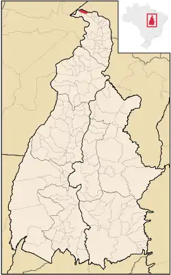 Location of São Sebastião do Tocantins in the State of Tocantins | |
| Coordinates: 05°15′25″S 48°12′00″W / 5.25694°S 48.20000°W | |
| Country | |
| Region | North |
| State | |
| Government | |
| • Mayor | Vilmede Alves de Sousa (PPS) |
| Area | |
| • Total | 287.271 km2 (110.916 sq mi) |
| Elevation | 105 m (344 ft) |
| Population (2020 [1]) | |
| • Total | 4,852 |
| • Density | 15.8/km2 (41/sq mi) |
| Time zone | UTC−3 (BRT) |
| HDI (2000) | 0.610 – medium[2] |
São Sebastião do Tocantins is the northernmost city in the state of Tocantins.
References
- ↑ "IBGE 2020". Retrieved 26 January 2021.
- ↑ - UNDP
This article is issued from Wikipedia. The text is licensed under Creative Commons - Attribution - Sharealike. Additional terms may apply for the media files.