Saint-Étienne-la-Geneste | |
|---|---|
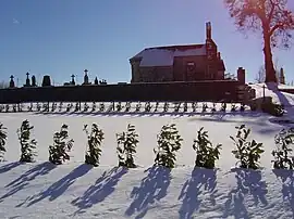 The church in Saint-Étienne-la-Geneste | |
.svg.png.webp) Coat of arms | |
Location of Saint-Étienne-la-Geneste | |
 Saint-Étienne-la-Geneste  Saint-Étienne-la-Geneste | |
| Coordinates: 45°26′50″N 2°20′47″E / 45.4472°N 2.3464°E | |
| Country | France |
| Region | Nouvelle-Aquitaine |
| Department | Corrèze |
| Arrondissement | Ussel |
| Canton | Haute-Dordogne |
| Intercommunality | Haute-Corrèze Communauté |
| Government | |
| • Mayor (2020–2026) | Christophe Tur[1] |
| Area 1 | 5.01 km2 (1.93 sq mi) |
| Population | 88 |
| • Density | 18/km2 (45/sq mi) |
| Time zone | UTC+01:00 (CET) |
| • Summer (DST) | UTC+02:00 (CEST) |
| INSEE/Postal code | 19200 /19160 |
| Elevation | 545–637 m (1,788–2,090 ft) (avg. 680 m or 2,230 ft) |
| 1 French Land Register data, which excludes lakes, ponds, glaciers > 1 km2 (0.386 sq mi or 247 acres) and river estuaries. | |
Saint-Étienne-la-Geneste is a commune in the Corrèze department in central France.
Geography
The river Diège forms all of the commune's eastern boundary.
Population
| Year | Pop. | ±% |
|---|---|---|
| 1962 | 71 | — |
| 1968 | 85 | +19.7% |
| 1975 | 58 | −31.8% |
| 1982 | 55 | −5.2% |
| 1990 | 62 | +12.7% |
| 1999 | 61 | −1.6% |
| 2008 | 80 | +31.1% |
See also
References
- ↑ "Répertoire national des élus: les maires" (in French). data.gouv.fr, Plateforme ouverte des données publiques françaises. 13 September 2022.
- ↑ "Populations légales 2021". The National Institute of Statistics and Economic Studies. 28 December 2023.
Wikimedia Commons has media related to Saint-Étienne-la-Geneste.
This article is issued from Wikipedia. The text is licensed under Creative Commons - Attribution - Sharealike. Additional terms may apply for the media files.