Saint-Côme–Linière | |
|---|---|
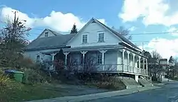 House in Saint-Côme–Linière | |
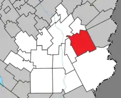 Location within Beauce-Sartigan RCM. | |
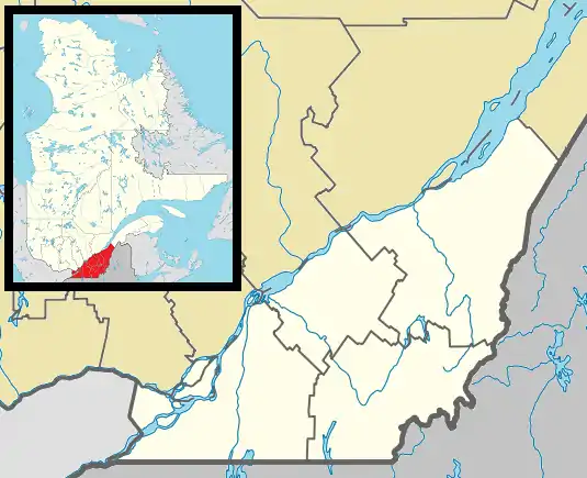 Saint-Côme–Linière Location in southern Quebec. | |
| Coordinates: 46°04′N 70°31′W / 46.067°N 70.517°W[1] | |
| Country | |
| Province | |
| Region | Chaudière-Appalaches |
| RCM | Beauce-Sartigan |
| Constituted | April 13, 1994 |
| Government | |
| • Mayor | Gabriel Giguère |
| • Federal riding | Beauce |
| • Prov. riding | Beauce-Sud |
| Area | |
| • Total | 152.20 km2 (58.76 sq mi) |
| • Land | 150.45 km2 (58.09 sq mi) |
| Population (2021)[3] | |
| • Total | 3,278 |
| • Density | 21.8/km2 (56/sq mi) |
| • Pop 2016-2021 | |
| • Dwellings | 1,537 |
| Time zone | UTC−5 (EST) |
| • Summer (DST) | UTC−4 (EDT) |
| Postal code(s) | |
| Area code(s) | 418 and 581 |
| Highways | |
| Website | www |
Saint-Côme–Linière (French pronunciation: [sɛ̃ kom linjɛʁ]) is a municipality in the Beauce-Sartigan Regional County Municipality in the Chaudière-Appalaches region of Quebec, Canada. The official spelling given by the Commission de toponymie uses an en dash after "Saint-Côme",[1][2] but the town's own website uses a second hyphen: Saint-Côme—Linière.[4] The population is 3,278 as of 2021.
Saint-Côme–Linière was constituted by the amalgamation of the parish municipality of Saint-Côme-de-Kennebec and the village of Linière on August 17, 1994. Saint-Côme was named after Arabian-born Christian martyr Saint Cosmas and Linière received its name from the Lord who was first granted the land and cultivated fields of flax ("Lin" in French).[1]
Demographics
Population
Population trend:[5]
| Census | Population | Change (%) |
|---|---|---|
| 2021 | 3,278 | |
| 2016 | 3,239 | |
| 2011 | 3,274 | |
| 2006 | 3,260 | |
| 2001 | 3,239 | |
| 1996 | 3,241 | |
| 1991 | 1,958 | |
| 1986 | 1,583 | |
| 1981 | 1,699 | |
| 1976 | 1,384 | |
| 1971 | 1,372 | |
| 1966 | 1,829 | |
| 1961 | 1,615 | |
| 1956 | 1,646 | |
| 1951 | 1,515 | |
| 1941 | 1,511 | |
| 1931 | 1,220 | |
| 1921 | 1,141 | |
| 1911 | 1,747 | |
| 1901 | 1,339 | |
Elected representatives
Gabriel Giguère, mayor
References
- 1 2 3 "Banque de noms de lieux du Québec: Reference number 288955". toponymie.gouv.qc.ca (in French). Commission de toponymie du Québec.
- 1 2 3 "Répertoire des municipalités: Geographic code 29057". www.mamh.gouv.qc.ca (in French). Ministère des Affaires municipales et de l'Habitation.
- 1 2 "Census Profile, 2021 Census, Statistics Canada - Validation Error".
- ↑ official website
- ↑ Statistics Canada: 1996, 2001, 2006, 2011, 2016, 2021 census
Places adjacent to Saint-Côme–Linière, Quebec | ||||||||||||||||
|---|---|---|---|---|---|---|---|---|---|---|---|---|---|---|---|---|
| ||||||||||||||||
| Cities & Towns | |
|---|---|
| Municipalities | |
| Parishes | |
| Villages | |
| |