Saint-Cernin-de-l'Herm | |
|---|---|
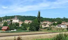 A general view of Saint-Cernin-de-l'Herm | |
Location of Saint-Cernin-de-l'Herm | |
 Saint-Cernin-de-l'Herm  Saint-Cernin-de-l'Herm | |
| Coordinates: 44°38′29″N 1°02′06″E / 44.6414°N 1.035°E | |
| Country | France |
| Region | Nouvelle-Aquitaine |
| Department | Dordogne |
| Arrondissement | Sarlat-la-Canéda |
| Canton | Vallée Dordogne |
| Government | |
| • Mayor (2020–2026) | Daniel Conchou[1] |
| Area 1 | 16.25 km2 (6.27 sq mi) |
| Population | 200 |
| • Density | 12/km2 (32/sq mi) |
| Time zone | UTC+01:00 (CET) |
| • Summer (DST) | UTC+02:00 (CEST) |
| INSEE/Postal code | 24386 /24550 |
| Elevation | 146–306 m (479–1,004 ft) (avg. 166 m or 545 ft) |
| 1 French Land Register data, which excludes lakes, ponds, glaciers > 1 km2 (0.386 sq mi or 247 acres) and river estuaries. | |
Saint-Cernin-de-l'Herm (French pronunciation: [sɛ̃ sɛʁnɛ̃ də lɛʁm]; Occitan: Sent Sarnin de l'Èrm) is a commune in the Dordogne department in Nouvelle-Aquitaine in southwestern France.
Population
| Year | Pop. | ±% |
|---|---|---|
| 1962 | 315 | — |
| 1968 | 305 | −3.2% |
| 1975 | 273 | −10.5% |
| 1982 | 249 | −8.8% |
| 1990 | 222 | −10.8% |
| 1999 | 230 | +3.6% |
| 2008 | 248 | +7.8% |
See also
References
- ↑ "Répertoire national des élus: les maires". data.gouv.fr, Plateforme ouverte des données publiques françaises (in French). 9 August 2021.
- ↑ "Populations légales 2021". The National Institute of Statistics and Economic Studies. 28 December 2023.
Wikimedia Commons has media related to Saint-Cernin-de-l'Herm.
This article is issued from Wikipedia. The text is licensed under Creative Commons - Attribution - Sharealike. Additional terms may apply for the media files.