Saint-Morillon | |
|---|---|
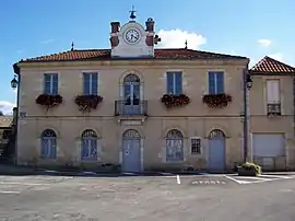 The town hall in Saint-Morillon | |
Location of Saint-Morillon | |
 Saint-Morillon  Saint-Morillon | |
| Coordinates: 44°39′02″N 0°30′05″W / 44.6506°N 0.5014°W | |
| Country | France |
| Region | Nouvelle-Aquitaine |
| Department | Gironde |
| Arrondissement | Bordeaux |
| Canton | La Brède |
| Intercommunality | Montesquieu |
| Government | |
| • Mayor (2020–2026) | Laurence Bourgade[1] |
| Area 1 | 20.4 km2 (7.9 sq mi) |
| Population | 1,786 |
| • Density | 88/km2 (230/sq mi) |
| Time zone | UTC+01:00 (CET) |
| • Summer (DST) | UTC+02:00 (CEST) |
| INSEE/Postal code | 33454 /33650 |
| Elevation | 15–67 m (49–220 ft) (avg. 6 m or 20 ft) |
| 1 French Land Register data, which excludes lakes, ponds, glaciers > 1 km2 (0.386 sq mi or 247 acres) and river estuaries. | |
Saint-Morillon (French pronunciation: [sɛ̃ mɔʁijɔ̃]; Gascon: Sent Maurilhon) is a commune in the Gironde department in Nouvelle-Aquitaine in southwestern France.
Population
| Year | Pop. | ±% |
|---|---|---|
| 1962 | 475 | — |
| 1968 | 507 | +6.7% |
| 1975 | 566 | +11.6% |
| 1982 | 722 | +27.6% |
| 1990 | 846 | +17.2% |
| 1999 | 1,083 | +28.0% |
| 2008 | 1,445 | +33.4% |
See also
References
- ↑ "Répertoire national des élus: les maires" (in French). data.gouv.fr, Plateforme ouverte des données publiques françaises. 13 September 2022.
- ↑ "Populations légales 2021". The National Institute of Statistics and Economic Studies. 28 December 2023.
Wikimedia Commons has media related to Saint-Morillon.
This article is issued from Wikipedia. The text is licensed under Creative Commons - Attribution - Sharealike. Additional terms may apply for the media files.