Saint-Omer | |
|---|---|
 | |
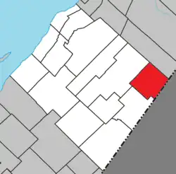 Location within L'Islet RCM | |
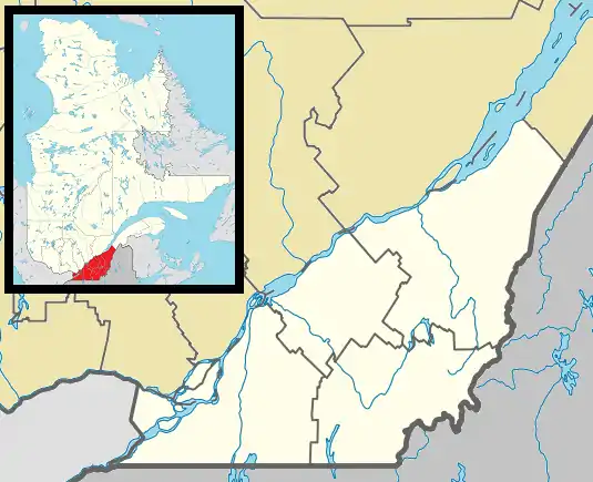 Saint-Omer Location in southern Quebec | |
| Coordinates: 47°03′N 69°44′W / 47.050°N 69.733°W[1] | |
| Country | |
| Province | |
| Region | Chaudière-Appalaches |
| RCM | L'Islet |
| Constituted | January 1, 1954 |
| Government | |
| • Mayor | Huguette Gauthier-Roy |
| • Federal riding | Montmagny—L'Islet— Kamouraska—Rivière- du-Loup |
| • Prov. riding | Côte-du-Sud |
| Area | |
| • Total | 122.40 km2 (47.26 sq mi) |
| • Land | 122.44 km2 (47.27 sq mi) |
| There is an apparent contradiction between two authoritative sources. | |
| Population | |
| • Total | 294 |
| • Density | 2.4/km2 (6/sq mi) |
| • Pop 2016-2021 | |
| • Dwellings | 203 |
| Time zone | UTC−5 (EST) |
| • Summer (DST) | UTC−4 (EDT) |
| Postal code(s) | |
| Area code(s) | 418 and 581 |
| Highways | No major routes |
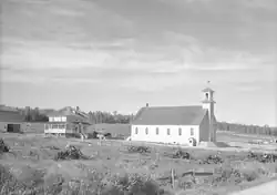
Saint-Omer is a municipality in L'Islet Regional County Municipality in the Chaudière-Appalaches region of Quebec, Canada.
See also
References
- ↑ "Banque de noms de lieux du Québec: Reference number 57337". toponymie.gouv.qc.ca (in French). Commission de toponymie du Québec.
- 1 2 "Répertoire des municipalités: Geographic code 17005". www.mamh.gouv.qc.ca (in French). Ministère des Affaires municipales et de l'Habitation.
- 1 2 "Census Profile, 2021 Census - Saint-Omer, Municipalité". 29 March 2023.
External links
 Media related to Saint-Omer, Chaudière-Appalaches, Quebec at Wikimedia Commons
Adjacent Municipal Subdivisions | |
|---|---|
| Cities & Towns | |
|---|---|
| Municipalities | |
| Parishes | |
| |
This article is issued from Wikipedia. The text is licensed under Creative Commons - Attribution - Sharealike. Additional terms may apply for the media files.