Saint-Père | |
|---|---|
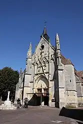 The church in Saint-Père | |
Location of Saint-Père | |
 Saint-Père  Saint-Père | |
| Coordinates: 47°24′45″N 2°57′39″E / 47.41250°N 2.9608°E | |
| Country | France |
| Region | Bourgogne-Franche-Comté |
| Department | Nièvre |
| Arrondissement | Cosne-Cours-sur-Loire |
| Canton | Cosne-Cours-sur-Loire |
| Government | |
| • Mayor (2020–2026) | Jocelyne Vernaux[1] |
| Area 1 | 17.09 km2 (6.60 sq mi) |
| Population | 1,046 |
| • Density | 61/km2 (160/sq mi) |
| Time zone | UTC+01:00 (CET) |
| • Summer (DST) | UTC+02:00 (CEST) |
| INSEE/Postal code | 58261 /58200 |
| Elevation | 145–248 m (476–814 ft) |
| 1 French Land Register data, which excludes lakes, ponds, glaciers > 1 km2 (0.386 sq mi or 247 acres) and river estuaries. | |
Saint-Père (French pronunciation: [sɛ̃ pɛʁ] ⓘ) is a commune in the Nièvre department in central France.[3]
See also
References
- ↑ "Répertoire national des élus: les maires". data.gouv.fr, Plateforme ouverte des données publiques françaises (in French). 2 December 2020.
- ↑ "Populations légales 2021". The National Institute of Statistics and Economic Studies. 28 December 2023.
- ↑ INSEE commune file
Wikimedia Commons has media related to Saint-Père (Nièvre).
This article is issued from Wikipedia. The text is licensed under Creative Commons - Attribution - Sharealike. Additional terms may apply for the media files.