Saint-Salvadou | |
|---|---|
Part of Le Bas Ségala | |
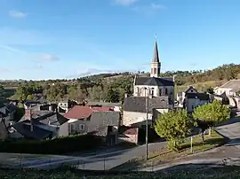 The church and surrounding buildings in Saint-Salvadou | |
Location of Saint-Salvadou | |
 Saint-Salvadou  Saint-Salvadou | |
| Coordinates: 44°16′55″N 2°06′06″E / 44.2819°N 2.1017°E | |
| Country | France |
| Region | Occitania |
| Department | Aveyron |
| Arrondissement | Villefranche-de-Rouergue |
| Canton | Aveyron et Tarn |
| Commune | Le Bas Ségala |
| Area 1 | 15.5 km2 (6.0 sq mi) |
| Population (2021)[1] | 390 |
| • Density | 25/km2 (65/sq mi) |
| Time zone | UTC+01:00 (CET) |
| • Summer (DST) | UTC+02:00 (CEST) |
| Postal code | 12200 |
| Elevation | 369–610 m (1,211–2,001 ft) (avg. 460 m or 1,510 ft) |
| 1 French Land Register data, which excludes lakes, ponds, glaciers > 1 km2 (0.386 sq mi or 247 acres) and river estuaries. | |
Saint-Salvadou (French pronunciation: [sɛ̃ salvadu]; Languedocien: Sent Sauvador) is a former commune in the Aveyron department in southern France. On 1 January 2016, it was merged into the new commune of Le Bas Ségala.[2]
Population
| Year | Pop. | ±% |
|---|---|---|
| 1962 | 527 | — |
| 1968 | 608 | +15.4% |
| 1975 | 546 | −10.2% |
| 1982 | 520 | −4.8% |
| 1990 | 505 | −2.9% |
| 1999 | 432 | −14.5% |
| 2008 | 402 | −6.9% |
See also
References
- ↑ "Populations légales 2021" [Legal populations 2021] (PDF) (in French). INSEE. December 2023.
- ↑ Arrêté préfectoral 6 November 2015
Wikimedia Commons has media related to Saint-Salvadou.
This article is issued from Wikipedia. The text is licensed under Creative Commons - Attribution - Sharealike. Additional terms may apply for the media files.