Saint Louis Crossing | |
|---|---|
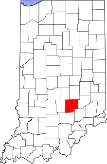 Bartholomew County's location in Indiana | |
 Saint Louis Crossing Location in Bartholomew County | |
| Coordinates: 39°19′08″N 85°50′48″W / 39.31889°N 85.84667°W | |
| Country | United States |
| State | Indiana |
| County | Bartholomew |
| Township | Flat Rock |
| Elevation | 682 ft (208 m) |
| Time zone | UTC-5 (Eastern (EST)) |
| • Summer (DST) | UTC-4 (EDT) |
| ZIP code | 47246 |
| FIPS code | 18-66996[2] |
| GNIS feature ID | 442661 |
Saint Louis Crossing is an unincorporated community in Flat Rock Township, Bartholomew County, in the U.S. state of Indiana.[3]
History
Saint Louis Crossing was at a crossing on the Columbus & Shelbyville Railroad[4] outside of Old Saint Louis, hence the name.[5] A post office was established at Saint Louis Crossing in 1862, and remained in operation until it was discontinued in 1974.[6]
Geography
Saint Louis Crossing is located at 39°19′08″N 85°50′48″W / 39.31889°N 85.84667°W.
References
- ↑ "US Board on Geographic Names". United States Geological Survey. October 25, 2007. Retrieved January 31, 2008.
- ↑ "U.S. Census website". United States Census Bureau. Retrieved January 31, 2008.
- ↑ "Saint Louis Crossing, Indiana". Geographic Names Information System. United States Geological Survey. Retrieved February 22, 2020.
- ↑ Redfield & Logan's Columbus & Indianapolis Central Railway Business Guide, and Western Gazetteer of Indiana and Ohio for. Redfield & Logan. 1866. p. 42.
- ↑ Baker, Ronald L. (October 1995). From Needmore to Prosperity: Hoosier Place Names in Folklore and History. Indiana University Press. p. 290. ISBN 978-0-253-32866-3.
...on the railroad west of Saint Louis (now Old Saint Louis) for which it was named.
- ↑ "Bartholomew County". Jim Forte Postal History. Retrieved February 22, 2020.
Municipalities and communities of Bartholomew County, Indiana, United States | ||
|---|---|---|
| City | Map of Indiana highlighting Bartholomew County | |
| Towns | ||
| Townships | ||
| CDPs | ||
| Other communities | ||
| Ghost town | ||
| Footnotes | ‡This populated place also has portions in an adjacent county or counties | |
This article is issued from Wikipedia. The text is licensed under Creative Commons - Attribution - Sharealike. Additional terms may apply for the media files.