Sainte-Brigide-d'Iberville | |
|---|---|
 | |
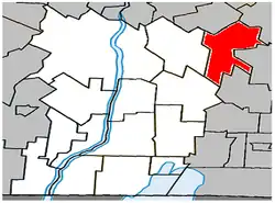 Location within Le Haut-Richelieu RCM | |
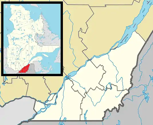 Sainte-Brigide-d'Iberville Location in southern Quebec | |
| Coordinates: 45°19′N 73°04′W / 45.317°N 73.067°W[1] | |
| Country | |
| Province | |
| Region | Montérégie |
| RCM | Le Haut-Richelieu |
| Constituted | July 1, 1855 |
| Government | |
| • Mayor | Patrick Bonvouloir |
| • Federal riding | Saint-Jean |
| • Prov. riding | Iberville |
| Area | |
| • Total | 70.90 km2 (27.37 sq mi) |
| • Land | 71.28 km2 (27.52 sq mi) |
| There is an apparent contradiction between two authoritative sources | |
| Population (2011)[4] | |
| • Total | 1,331 |
| • Density | 18.7/km2 (48/sq mi) |
| • Pop 2006-2011 | |
| • Dwellings | 522 |
| Time zone | UTC−5 (EST) |
| • Summer (DST) | UTC−4 (EDT) |
| Postal code(s) | |
| Area code(s) | 450 and 579 |
| Highways | |
| Website | www |
Sainte-Brigide-d'Iberville (French pronunciation: [sɛ̃t bʁiʒid dibɛʁvil]) is a municipality in the province of Quebec, Canada, located in the Regional County Municipality of Le Haut-Richelieu. The population as of the Canada 2011 Census was 1,331.
Demographics
Population
Canada census – Sainte-Brigide-d'Iberville community profile
| 2021 | 2011 | |
|---|---|---|
| Population | 1,428 (+1.9% from 2016) | 1,331 (+8.8% from 2006) |
| Land area | 70.52 km2 (27.23 sq mi) | 71.28 km2 (27.52 sq mi) |
| Population density | 20.3/km2 (53/sq mi) | 18.7/km2 (48/sq mi) |
| Median age | 38.8 (M: 38.8, F: 38.4) | 37.0 (M: 36.8, F: 37.2) |
| Private dwellings | 565 (total) | 522 (total) |
| Median household income | $.N/A |
|
|
|
Language
| Canada Census Mother Tongue - Sainte-Brigide-d'Iberville, Quebec[8] | ||||||||||||||||||
|---|---|---|---|---|---|---|---|---|---|---|---|---|---|---|---|---|---|---|
| Census | Total | French |
English |
French & English |
Other | |||||||||||||
| Year | Responses | Count | Trend | Pop % | Count | Trend | Pop % | Count | Trend | Pop % | Count | Trend | Pop % | |||||
2011 |
1,330 |
1,245 | 93.61% | 30 | 2.26% | 10 | 0.75% | 45 | 3.38% | |||||||||
2006 |
1,230 |
1,125 | 91.46% | 30 | 2.44% | 0 | 0.00% | 75 | 6.10% | |||||||||
2001 |
1,275 |
1,215 | 95.29% | 10 | 0.78% | 10 | 0.78% | 40 | 3.14% | |||||||||
1996 |
1,370 |
1,330 | n/a | 97.08% | 25 | n/a | 1.82% | 0 | n/a | 0.00% | 15 | n/a | 1.09% | |||||
See also
References
- ↑ "Banque de noms de lieux du Québec: Reference number 56070". toponymie.gouv.qc.ca (in French). Commission de toponymie du Québec.
- 1 2 Ministère des Affaires municipales, des Régions et de l'Occupation du territoire: Sainte-Brigide-d'Iberville
- ↑ Parliament of Canada Federal Riding History: SAINT-JEAN (Quebec)
- 1 2 3 "2011 Community Profiles". 2011 Canadian Census. Statistics Canada. March 21, 2019. Retrieved 2014-04-06.
- ↑ "2021 Community Profiles". 2021 Canadian Census. Statistics Canada. February 4, 2022. Retrieved 2022-04-27.
- ↑ "2006 Community Profiles". 2006 Canadian Census. Statistics Canada. August 20, 2019.
- ↑ "2001 Community Profiles". 2001 Canadian Census. Statistics Canada. July 18, 2021.
- 1 2 Statistics Canada: 1996, 2001, 2006, 2011 census
Wikimedia Commons has media related to Sainte-Brigide-d'Iberville.
Adjacent Municipal Subdivisions | ||||||||||||||||
|---|---|---|---|---|---|---|---|---|---|---|---|---|---|---|---|---|
| ||||||||||||||||
| Cities & Towns | |
|---|---|
| Municipalities | |
| Parishes | |
| |
This article is issued from Wikipedia. The text is licensed under Creative Commons - Attribution - Sharealike. Additional terms may apply for the media files.