Sambreville
| |
|---|---|
_Didier_Misson.JPG.webp) Auvelais | |
 Flag  Coat of arms | |
Location of Sambreville | |
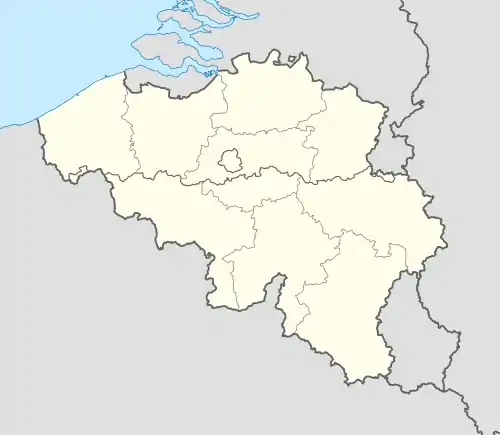 Sambreville Location in Belgium
Location of Sambreville in Namur Province 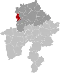 | |
| Coordinates: 50°27′N 04°36′E / 50.450°N 4.600°E | |
| Country | |
| Community | French Community |
| Region | Wallonia |
| Province | Namur |
| Arrondissement | Namur |
| Government | |
| • Mayor | Jean-Charles Luperto.[1] Denis Lisélélé (acting mayor)[2] |
| • Governing party/ies | PS |
| Area | |
| • Total | 34.27 km2 (13.23 sq mi) |
| Population (2018-01-01)[3] | |
| • Total | 28,211 |
| • Density | 820/km2 (2,100/sq mi) |
| Postal codes | 5060 |
| NIS code | 92137 |
| Area codes | 071 |
| Website | www.sambreville.be |
Sambreville (French pronunciation: [sɑ̃bʁəvil]; Walloon: Sambveye) is a municipality of Wallonia located in the province of Namur, Belgium.
On January 1, 2006, Sambreville had a total population of 26,949. The total area is 34.20 km2 (13.20 sq mi) which gives a population density of 788 inhabitants per square kilometre (2,040/sq mi).
Villages and towns
The municipality was created in 1977, as part of the post-1974 fusion of the Belgian municipalities, bringing together the ancienne communes (now towns and villages) of:
Tamines is associated with the Rape of Belgium during World War I. At least 384 townspeople were massacred, including women and children.
Twin towns
 Gessopalena, Italy
See also
References
- ↑ "Luperto stapt op als parlementsvoorzitter maar ontkent openbare zedenschennis". vandaag.be (in Dutch).
- ↑ "Philippe Courard en Denis Lisélélé nemen activiteiten Luperto over". HLN (in Dutch).
- ↑ "Wettelijke Bevolking per gemeente op 1 januari 2018". Statbel. Retrieved 9 March 2019.
External links
 Media related to Sambreville at Wikimedia Commons
- Official website
Places adjacent to Sambreville | ||||||||||||||||
|---|---|---|---|---|---|---|---|---|---|---|---|---|---|---|---|---|
| ||||||||||||||||
Municipalities in the province of Namur, Wallonia | ||
|---|---|---|
| Dinant |  | |
| Namur | ||
| Philippeville | ||
Bold indicates cities | ||
This article is issued from Wikipedia. The text is licensed under Creative Commons - Attribution - Sharealike. Additional terms may apply for the media files.