Samerberg | |
|---|---|
 General view of Törwang. Hochries seen in the background. | |
 Coat of arms | |
Location of Samerberg within Rosenheim district 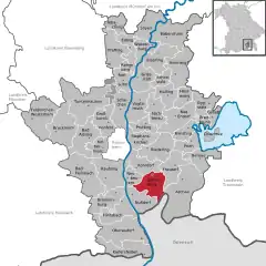 | |
 Samerberg 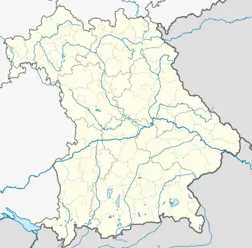 Samerberg | |
| Coordinates: 47°47′N 12°13′E / 47.783°N 12.217°E | |
| Country | Germany |
| State | Bavaria |
| Admin. region | Oberbayern |
| District | Rosenheim |
| Government | |
| • Mayor (2020–26) | Georg Huber[1] |
| Area | |
| • Total | 33.39 km2 (12.89 sq mi) |
| Elevation | 700 m (2,300 ft) |
| Population (2022-12-31)[2] | |
| • Total | 2,882 |
| • Density | 86/km2 (220/sq mi) |
| Time zone | UTC+01:00 (CET) |
| • Summer (DST) | UTC+02:00 (CEST) |
| Postal codes | 83122 |
| Dialling codes | 08032 |
| Vehicle registration | RO |
| Website | www.samerberg.de |
Samerberg is a municipality in the district of Rosenheim in Bavaria in Germany.
It consists of 78 hamlets and localities, none of them bearing the name Samerberg itself, the seat is in Törwang.[3]
References
- ↑ Liste der ersten Bürgermeister/Oberbürgermeister in kreisangehörigen Gemeinden, Bayerisches Landesamt für Statistik, 15 July 2021.
- ↑ Genesis Online-Datenbank des Bayerischen Landesamtes für Statistik Tabelle 12411-003r Fortschreibung des Bevölkerungsstandes: Gemeinden, Stichtag (Einwohnerzahlen auf Grundlage des Zensus 2011)
- ↑ "Samerberg | bavarikon".
This article is issued from Wikipedia. The text is licensed under Creative Commons - Attribution - Sharealike. Additional terms may apply for the media files.