San Bartolomeo al Mare | |
|---|---|
| Comune di San Bartolomeo al Mare | |
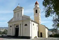 Church of Our Lady | |
Location of San Bartolomeo al Mare | |
 San Bartolomeo al Mare Location of San Bartolomeo al Mare in Italy  San Bartolomeo al Mare San Bartolomeo al Mare (Liguria) | |
| Coordinates: 43°55′N 8°6′E / 43.917°N 8.100°E | |
| Country | Italy |
| Region | Liguria |
| Province | Imperia (IM) |
| Government | |
| • Mayor | Valerio Urso |
| Area | |
| • Total | 10.85 km2 (4.19 sq mi) |
| Elevation | 26 m (85 ft) |
| Population (31 December 2015)[2] | |
| • Total | 3,129 |
| • Density | 290/km2 (750/sq mi) |
| Demonym | Sanbartolomeesi |
| Time zone | UTC+1 (CET) |
| • Summer (DST) | UTC+2 (CEST) |
| Postal code | 18016 |
| Dialing code | 0183 |
| Website | Official website |
San Bartolomeo al Mare (Ligurian: San Bartumé[3]) is a comune (municipality) in the Province of Imperia in the Italian region Liguria, located about 90 kilometres (56 mi) southwest of Genoa and about 7 kilometres (4 mi) northeast of Imperia.
San Bartolomeo al Mare borders the following municipalities: Andora, Cervo, Diano Castello, Diano Marina, Diano San Pietro, and Villa Faraldi.
Wikimedia Commons has media related to San Bartolomeo al Mare.
See also
References
- ↑ "Superficie di Comuni Province e Regioni italiane al 9 ottobre 2011". Italian National Institute of Statistics. Retrieved 16 March 2019.
- ↑ All demographics and other statistics: Italian statistical institute Istat.
- ↑ Frisoni, Gaetano [in Italian] (1910). Dizionario Genovese-Italiano e Italiano-Genovese (in Italian). Genova: Nuova Editrice Genovese.
External links
This article is issued from Wikipedia. The text is licensed under Creative Commons - Attribution - Sharealike. Additional terms may apply for the media files.