San Cesario sul Panaro | |
|---|---|
| Comune di San Cesario sul Panaro | |
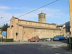 Romanesque cathedral of San Cesario sul Panaro. | |
 Coat of arms | |
Location of San Cesario sul Panaro | |
 San Cesario sul Panaro Location of San Cesario sul Panaro in Italy 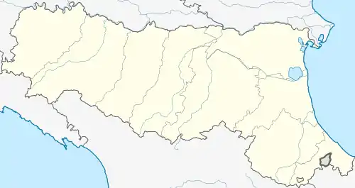 San Cesario sul Panaro San Cesario sul Panaro (Emilia-Romagna) | |
| Coordinates: 44°33′41″N 11°02′02″E / 44.56139°N 11.03389°E | |
| Country | Italy |
| Region | Emilia-Romagna |
| Province | Modena (MO) |
| Frazioni | Altolà, Ponte Sant'Ambrogio, Sant'Anna |
| Government | |
| • Mayor | Francesco Zuffi |
| Area | |
| • Total | 27.4 km2 (10.6 sq mi) |
| Highest elevation | 77 m (253 ft) |
| Lowest elevation | 33 m (108 ft) |
| Population (31 July 2015)[2] | |
| • Total | 6,412 |
| • Density | 230/km2 (610/sq mi) |
| Demonym | Sancesaresi |
| Time zone | UTC+1 (CET) |
| • Summer (DST) | UTC+2 (CEST) |
| Postal code | 41018 |
| Dialing code | 059 |
| Patron saint | San Cesario |
| Website | Official website |
San Cesario sul Panaro (Modenese: San Gèr; Western Bolognese: San Cesèri) is a comune (municipality) in the Province of Modena in the Italian region Emilia-Romagna, located about 25 km (16 mi) northwest of Bologna and about 12 km (7 mi) southeast of Modena. Sports car manufacturer Pagani is located here. The town has a Romanesque-style church dedicated to Saint Caesarius of Terracina.
The battle of San Cesario took place in the area in August 1229.
References
- ↑ "Superficie di Comuni Province e Regioni italiane al 9 ottobre 2011". Italian National Institute of Statistics. Retrieved 16 March 2019.
- ↑ All demographics and other statistics: Italian statistical institute Istat.
External links
This article is issued from Wikipedia. The text is licensed under Creative Commons - Attribution - Sharealike. Additional terms may apply for the media files.