Sangthong district
ສັງທອງ Sangthong | |
|---|---|
Town | |
 | |
| Coordinates: 18°05′27″N 102°17′24″E / 18.09083°N 102.29000°E | |
| Country | Laos |
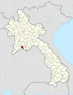
| Province | Vientiane Prefecture |
| District | Sangthong |
| Population (2015) | |
| • Total | 29,509 |
| Time zone | UTC+7 (ICT) |
Sangthong is a district of Vientiane Prefecture, Laos.[1][2]
References
- ↑ Google Maps (Map). Google.
- ↑ Bing Maps (Map). Microsoft and Harris Corporation Earthstar Geographics LLC.
This article is issued from Wikipedia. The text is licensed under Creative Commons - Attribution - Sharealike. Additional terms may apply for the media files.