Sankt Katharein an der Laming | |
|---|---|
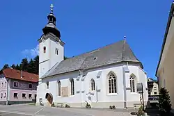 Sankt Katharein an der Laming parish church | |
 Coat of arms | |
 Sankt Katharein an der Laming Location within Austria | |
| Coordinates: 47°28′00″N 15°09′00″E / 47.46667°N 15.15000°E | |
| Country | Austria |
| State | Styria |
| District | Bruck-Mürzzuschlag |
| Government | |
| • Mayor | Hubert Zinner (ÖVP) |
| Area | |
| • Total | 43.88 km2 (16.94 sq mi) |
| Elevation | 651 m (2,136 ft) |
| Population (1 January 2016)[1] | |
| • Total | 971 |
| • Density | 22/km2 (57/sq mi) |
| Time zone | UTC+1 (CET) |
| • Summer (DST) | UTC+2 (CEST) |
| Postal code | 8611 |
| Area code | 0 38 69 |
| Vehicle registration | BM |
| Website | www.katharein.at/gemeinde |
Sankt Katharein an der Laming is a former municipality in the district of Bruck-Mürzzuschlag in Styria, Austria. Since the 2015 Styria municipal structural reform, it is part of the municipality Tragöß-Sankt Katharein.[2]
References
- ↑ Statistik Austria - Bevölkerung zu Jahresbeginn 2002-2016 nach Gemeinden (Gebietsstand 1.1.2016) for Sankt Katharein an der Laming.
- ↑ Die neue Gemeindestruktur der Steiermark
This article is issued from Wikipedia. The text is licensed under Creative Commons - Attribution - Sharealike. Additional terms may apply for the media files.