Sankt Martin im Sulmtal | |
|---|---|
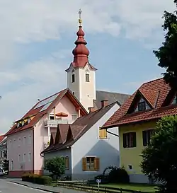 View with parish church | |
 Coat of arms | |
 Sankt Martin im Sulmtal Location within Austria | |
| Coordinates: 46°45′00″N 15°18′00″E / 46.75000°N 15.30000°E | |
| Country | Austria |
| State | Styria |
| District | Deutschlandsberg |
| Government | |
| • Mayor | Franz Silly (ÖVP) |
| Area | |
| • Total | 39.16 km2 (15.12 sq mi) |
| Elevation | 333 m (1,093 ft) |
| Population (2018-01-01)[2] | |
| • Total | 3,059 |
| • Density | 78/km2 (200/sq mi) |
| Time zone | UTC+1 (CET) |
| • Summer (DST) | UTC+2 (CEST) |
| Postal code | 8543, 8443, 8522, 8542, 8544, 8551 |
| Area code | +43 3465, 3457 |
| Vehicle registration | DL |
| Website | www.st-martin-i-s.at |
Sankt Martin im Sulmtal is a municipality in the district of Deutschlandsberg in the Austrian state of Styria.
Population
| Year | Pop. | ±% |
|---|---|---|
| 1869 | 2,969 | — |
| 1880 | 3,056 | +2.9% |
| 1890 | 3,116 | +2.0% |
| 1900 | 3,016 | −3.2% |
| 1910 | 2,903 | −3.7% |
| 1923 | 3,175 | +9.4% |
| 1934 | 3,209 | +1.1% |
| 1939 | 2,958 | −7.8% |
| 1951 | 3,404 | +15.1% |
| 1961 | 3,267 | −4.0% |
| 1971 | 3,331 | +2.0% |
| 1981 | 3,303 | −0.8% |
| 1991 | 3,492 | +5.7% |
| 2001 | 3,488 | −0.1% |
| 2011 | 3,155 | −9.5% |
| 2015 | 3,049 | −3.4% |
References
- ↑ "Dauersiedlungsraum der Gemeinden Politischen Bezirke und Bundesländer - Gebietsstand 1.1.2018". Statistics Austria. Retrieved 10 March 2019.
- ↑ "Einwohnerzahl 1.1.2018 nach Gemeinden mit Status, Gebietsstand 1.1.2018". Statistics Austria. Retrieved 9 March 2019.
This article is issued from Wikipedia. The text is licensed under Creative Commons - Attribution - Sharealike. Additional terms may apply for the media files.