| Sant Benet (Susqueda) | |
|---|---|
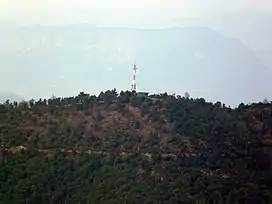 The summit seen from Sant Miquel de Solterra. | |
| Highest point | |
| Elevation | 1,147 m (3,763 ft) |
| Coordinates | 41°56′59.69″N 2°30′50.60″E / 41.9499139°N 2.5140556°E |
| Geography | |
| Location | Selva, Catalonia |
| Parent range | Guilleries |
| Climbing | |
| Easiest route | From Susqueda |
Sant Benet (Susqueda) is a mountain of the Guilleries Massif, Catalonia, Spain. It has an elevation of 1,146.9 metres above sea level.[1]
See also
References
- ↑ "Mapa Topogràfic de Catalunya". Institut Cartogràfic de Catalunya. Retrieved May 22, 2010..
This article is issued from Wikipedia. The text is licensed under Creative Commons - Attribution - Sharealike. Additional terms may apply for the media files.