Highway 56 | ||||
|---|---|---|---|---|
| Route information | ||||
| Maintained by Ministry of Highways and Infrastructure | ||||
| Length | 55.4 km[1] (34.4 mi) | |||
| Major junctions | ||||
| South end | ||||
| North end | ||||
| Location | ||||
| Country | Canada | |||
| Province | Saskatchewan | |||
| Rural municipalities | Indian Head, Abernethy, North Qu'Appelle | |||
| Highway system | ||||
|
| ||||
| ||||
.svg.png.webp)
Highway 56 is a provincial highway in the Canadian province of Saskatchewan. The highway runs from Highway 1 near Indian Head to Highway 210 within Echo Valley Provincial Park. It is about 55 kilometres (34 mi) long.[1]
Highway 56 travels along the eastern shore of Katepwa Lake and the northern shores of Mission and Echo Lakes of the Fishing Lakes.
Major intersections
From south to north:[2]
| Rural municipality | Location | km[1] | mi | Destinations | Notes |
|---|---|---|---|---|---|
| Indian Head No. 156 | Indian Head | 0.0 | 0.0 | Southern terminus | |
| ↑ / ↓ | | 24.2 | 15.0 | Crosses the Qu'Appelle River | |
| Abernethy No. 186 | Katepwa Beach | 26.9 | 16.7 | ||
| North Qu'Appelle No. 187 | Fort Qu'Appelle | 44.2 | 27.5 | ||
| Fort San | 49.0 | 30.4 | |||
| | 54.3 | 33.7 | |||
| Echo Valley Provincial Park | 54.8 | 34.1 | Crosses the Qu'Appelle River | ||
| 55.4 | 34.4 | Northern terminus | |||
| 1.000 mi = 1.609 km; 1.000 km = 0.621 mi | |||||
Photo gallery
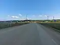 Hwy 56 through the Standing Buffalo IR
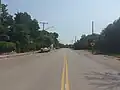 Hwy 56 through Lebret, facing east
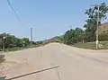 Hwy 56 through Lebret, facing west
See also
References
- 1 2 3 Google (12 February 2018). "Highway 56 in Saskatchewan" (Map). Google Maps. Google. Retrieved 12 February 2018.
- ↑ MapArt (2007). Saskatchewan Road Atlas (Map) (2007 ed.). 1:540,000. Oshawa, ON: Peter Heiler Ltd. pp. 42–43. ISBN 1-55368-020-0.
![]() Media related to Saskatchewan Highway 56 at Wikimedia Commons
Media related to Saskatchewan Highway 56 at Wikimedia Commons
This article is issued from Wikipedia. The text is licensed under Creative Commons - Attribution - Sharealike. Additional terms may apply for the media files.