| Schipbeek | |
|---|---|
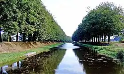 South of Holten | |
| Location | |
| Country | Netherlands |
| Physical characteristics | |
| Source | |
| • location | near Ahaus, Westphalia |
| • coordinates | 52°00′59″N 7°01′45″E / 52.01639°N 7.02917°E |
| Mouth | IJssel |
• location | Deventer |
• coordinates | 52°13′57″N 6°09′53″E / 52.2325°N 6.1647°E |
| Length | 85.2 km (52.9 mi) [1] |
| Basin size | 423 km2 (163 sq mi) [1] |
| Basin features | |
| Progression | IJssel→ IJsselmeer |
The Schipbeek is a tributary of the IJssel in the Netherlands and a continuation of the Buurserbeek. It flows into the IJssel near Deventer.
The real source of the Schipbeek is in Germany - in western Northrhine-Westphalia - in the Ahauser Aa, to which the Alstätter Aa, the Buurserbeek and finally the Schipbeek are connected.
References

This article is issued from Wikipedia. The text is licensed under Creative Commons - Attribution - Sharealike. Additional terms may apply for the media files.