Schlagsdorf | |
|---|---|
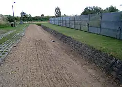 Part of the former Inner German border preserved at Museum Grenzhus in Schlagsdorf | |
 Coat of arms | |
Location of Schlagsdorf within Nordwestmecklenburg district 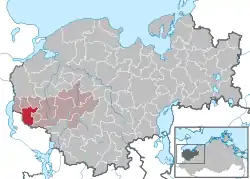 | |
 Schlagsdorf 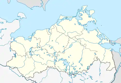 Schlagsdorf | |
| Coordinates: 53°43′N 10°49′E / 53.717°N 10.817°E | |
| Country | Germany |
| State | Mecklenburg-Vorpommern |
| District | Nordwestmecklenburg |
| Municipal assoc. | Rehna |
| Government | |
| • Mayor | Ingo Melchin |
| Area | |
| • Total | 20.12 km2 (7.77 sq mi) |
| Elevation | 39 m (128 ft) |
| Population (2021-12-31)[1] | |
| • Total | 1,203 |
| • Density | 60/km2 (150/sq mi) |
| Time zone | UTC+01:00 (CET) |
| • Summer (DST) | UTC+02:00 (CEST) |
| Postal codes | 19217 |
| Dialling codes | 038875 |
| Vehicle registration | NWM |
Schlagsdorf is a municipality in the Nordwestmecklenburg district, in Mecklenburg-Vorpommern, Germany.
References
- ↑ "Bevölkerungsstand der Kreise, Ämter und Gemeinden 2021" (XLS) (in German). Statistisches Amt Mecklenburg-Vorpommern. 2022.
This article is issued from Wikipedia. The text is licensed under Creative Commons - Attribution - Sharealike. Additional terms may apply for the media files.