Sergeant Township, Pennsylvania | |
|---|---|
.jpg.webp) U. S. Route 219 in the township | |
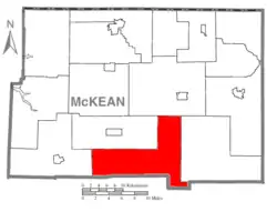 Map of McKean County, Pennsylvania highlighting Sergeant Township | |
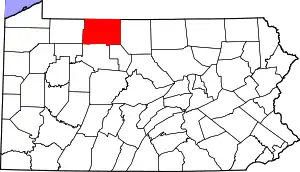 Map of McKean County, Pennsylvania | |
| Country | United States |
| State | Pennsylvania |
| County | McKean |
| Settled | 1809 |
| Incorporated | 1854 |
| Area | |
| • Total | 80.18 sq mi (207.67 km2) |
| • Land | 80.12 sq mi (207.50 km2) |
| • Water | 0.07 sq mi (0.17 km2) |
| Population | |
| • Total | 147 |
| • Estimate (2022)[2] | 143 |
| • Density | 1.69/sq mi (0.65/km2) |
| Time zone | UTC-5 (Eastern (EST)) |
| • Summer (DST) | UTC-4 (EDT) |
| Area code | 814 |
| FIPS code | 42-083-69304 |
Sergeant Township is a township in McKean County, Pennsylvania, United States. The population was 147 at the time of the 2020 census.[2]
Geography
According to the United States Census Bureau, the township has a total area of 80.3 square miles (208.0 km2), of which 80.3 square miles (207.9 km2) is land and 0.04 square mile (0.1 km2) (0.05%) is water.
Climate
Clermont is a populated place within the Sergeant Township.[3] Clermont has a humid continental climate (Köppen Dfb), with warm summers and cold, snowy winters.
| Climate data for Clermont 1 NW, Pennsylvania, 1991–2020 normals: 2080ft (634m) | |||||||||||||
|---|---|---|---|---|---|---|---|---|---|---|---|---|---|
| Month | Jan | Feb | Mar | Apr | May | Jun | Jul | Aug | Sep | Oct | Nov | Dec | Year |
| Record high °F (°C) | 63 (17) |
70 (21) |
78 (26) |
85 (29) |
89 (32) |
87 (31) |
98 (37) |
91 (33) |
87 (31) |
82 (28) |
75 (24) |
66 (19) |
98 (37) |
| Mean maximum °F (°C) | 53.0 (11.7) |
52.8 (11.6) |
63.6 (17.6) |
77.8 (25.4) |
83.1 (28.4) |
84.4 (29.1) |
85.8 (29.9) |
83.7 (28.7) |
81.0 (27.2) |
75.2 (24.0) |
66.3 (19.1) |
53.2 (11.8) |
86.1 (30.1) |
| Mean daily maximum °F (°C) | 29.3 (−1.5) |
32.0 (0.0) |
41.2 (5.1) |
55.1 (12.8) |
66.1 (18.9) |
73.0 (22.8) |
76.4 (24.7) |
74.4 (23.6) |
66.8 (19.3) |
56.6 (13.7) |
44.1 (6.7) |
33.6 (0.9) |
54.1 (12.3) |
| Daily mean °F (°C) | 21.3 (−5.9) |
23.0 (−5.0) |
31.0 (−0.6) |
43.2 (6.2) |
54.1 (12.3) |
61.9 (16.6) |
65.5 (18.6) |
63.9 (17.7) |
56.9 (13.8) |
46.6 (8.1) |
36.0 (2.2) |
26.6 (−3.0) |
44.2 (6.8) |
| Mean daily minimum °F (°C) | 13.2 (−10.4) |
14.0 (−10.0) |
20.8 (−6.2) |
31.3 (−0.4) |
42.0 (5.6) |
50.8 (10.4) |
54.6 (12.6) |
53.3 (11.8) |
46.9 (8.3) |
36.6 (2.6) |
27.9 (−2.3) |
19.6 (−6.9) |
34.3 (1.3) |
| Mean minimum °F (°C) | −8.4 (−22.4) |
−6.0 (−21.1) |
0.4 (−17.6) |
17.0 (−8.3) |
27.2 (−2.7) |
37.1 (2.8) |
43.5 (6.4) |
42.6 (5.9) |
34.7 (1.5) |
24.1 (−4.4) |
13.0 (−10.6) |
2.0 (−16.7) |
−11.4 (−24.1) |
| Record low °F (°C) | −18 (−28) |
−26 (−32) |
−17 (−27) |
10 (−12) |
20 (−7) |
31 (−1) |
38 (3) |
39 (4) |
29 (−2) |
17 (−8) |
0 (−18) |
−12 (−24) |
−26 (−32) |
| Average precipitation inches (mm) | 3.73 (95) |
2.96 (75) |
3.67 (93) |
4.43 (113) |
4.71 (120) |
4.72 (120) |
4.80 (122) |
4.79 (122) |
4.41 (112) |
4.38 (111) |
4.10 (104) |
4.11 (104) |
50.81 (1,291) |
| Average snowfall inches (cm) | 18.40 (46.7) |
19.10 (48.5) |
10.80 (27.4) |
4.00 (10.2) |
0.40 (1.0) |
0.00 (0.00) |
0.00 (0.00) |
0.00 (0.00) |
0.00 (0.00) |
1.50 (3.8) |
7.10 (18.0) |
18.20 (46.2) |
79.5 (201.8) |
| Source 1: NOAA[4] | |||||||||||||
| Source 2: XMACIS (temp records & monthly max/mins)[5] | |||||||||||||
Demographics
| Census | Pop. | Note | %± |
|---|---|---|---|
| 2000 | 176 | — | |
| 2010 | 141 | −19.9% | |
| 2020 | 147 | 4.3% | |
| 2022 (est.) | 143 | [2] | −2.7% |
| U.S. Decennial Census[6] | |||
As of the census[7] of 2000, there were one hundred and seventy-six people, seventy-seven households and fifty-eight families residing in the township.
The population density was 2.2 people per square mile (0.8/km2). There were three hundred and twenty-nine housing units at an average density of 4.1/sq mi (1.6/km2).
The racial makeup of the township was 96.02% White, 0.57% African American, and 3.41% from two or more races. Hispanic or Latino of any race were 2.27% of the population.
There were seventy-seven households, out of which 24.7% had children under the age of eighteen living with them; 66.2% were married couples living together, 6.5% had a female householder with no husband present, and 23.4% were non-families. 22.1% of all households were made up of individuals, and 11.7% had someone living alone who was sixty-five years of age or older. The average household size was 2.29 and the average family size was 2.64.
In the township, the population was spread out, with 17.6% under the age of eighteen, 5.1% from eighteen to twenty-four, 22.7% from twenty-five to forty-four, 33.5% from forty-five to sixty-four, and 21.0% who were sixty-five years of age or older. The median age was forty-eight years.
For every one hundred females, there were 114.6 males. For every one hundred females aged eighteen and over, there were 113.2 males.
The median income for a household in the township was $33,438, and the median income for a family was $37,813. Males had a median income of $33,000 compared with $21,875 for females. The per capita income for the township was $16,063.
About 6.2% of families and 9.8% of the population were below the poverty line, including 8.5% of those under the age of 18 and 18.4% of those 65 or over.
References
- ↑ "2016 U.S. Gazetteer Files". United States Census Bureau. Retrieved August 14, 2017.
- 1 2 3 4 Bureau, US Census. "City and Town Population Totals: 2020-2022". Census.gov. US Census Bureau. Retrieved October 22, 2023.
- ↑ "Station Details - Clermont (in McKean County, PA) Populated Place Profile". HomeTownLocator. Retrieved December 13, 2023.
- ↑ "Clermont 1 NW, Pennsylvania 1991-2020 Monthly Normals". Retrieved December 13, 2023.
- ↑ "xmACIS". National Oceanic and Atmospheric Administration. Retrieved December 13, 2023.
- ↑ "Census of Population and Housing". Census.gov. Retrieved June 4, 2016.
- ↑ "U.S. Census website". United States Census Bureau. Retrieved January 31, 2008.
Municipalities and communities of McKean County, Pennsylvania, United States | ||
|---|---|---|
| City | | |
| Boroughs | ||
| Townships | ||
| CDPs | ||
| Unincorporated communities | ||