| Sgùrr a' Mhadaidh | |
|---|---|
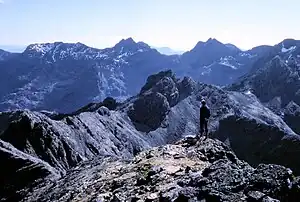
 Sgùrr a' Mhadaidh overlooking Coir' a' Mhadaidh | |
| Highest point | |
| Elevation | 918 m (3,012 ft)[1] |
| Prominence | 71 m (233 ft) |
| Listing | Munro |
| Coordinates | 57°13′51″N 6°14′01″W / 57.23083°N 6.23361°W |
| Naming | |
| English translation | peak of the dog / fox |
| Language of name | Gaelic |
| Pronunciation | Scottish Gaelic: [ˈs̪kuːrˠ ə ˈvat̪ɪ] |
| Geography | |
 Sgùrr a' Mhadaidh Location in Skye | |
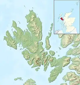
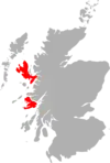
| Location | Skye, Scotland |
| Parent range | Cuillin |
| OS grid | NG446235 |
| Topo map | OS Landranger 32 |
| Climbing | |
| First ascent | Possibly 1887, John MacKenzie and H.C. Hart |
| Easiest route | Scramble |
Sgùrr a' Mhadaidh (Scottish Gaelic for 'peak of the dog / fox')[2] is a mountain peak in the Black Cuillin range on the Isle of Skye, Scotland. It is a Munro with a height of 918 metres (3,012 ft). Like the rest of the range it is composed of gabbro, a rock with excellent grip for mountaineering.
The simplest route ascends via the col of An Dorus (the Door), most easily reached from Glen Brittle. The mountain has four summits; only the highest can be reached by scramblers. The three lower summits require rock-climbing skills and equipment.
References
- ↑ "walkhighlands x". walkhighlands.co.uk. walkhighlands.co.uk. 2013. Retrieved 14 October 2013.
- ↑ "Sgurr a' Mhadaidh". Ainmean-Àite na h-Alba: Gaelic Place-Names of Scotland.
This article is issued from Wikipedia. The text is licensed under Creative Commons - Attribution - Sharealike. Additional terms may apply for the media files.