Shepardsville, Indiana | |
|---|---|
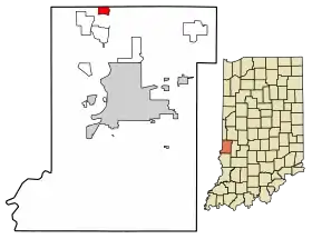 Location of Shepardsville in Vigo County, Indiana. | |
| Coordinates: 39°36′3″N 87°25′3″W / 39.60083°N 87.41750°W | |
| Country | United States |
| State | Indiana |
| County | Vigo |
| Township | Fayette |
| Area | |
| • Total | 0.92 sq mi (2.39 km2) |
| • Land | 0.92 sq mi (2.38 km2) |
| • Water | 0.00 sq mi (0.01 km2) |
| Elevation | 499 ft (152 m) |
| Population (2020) | |
| • Total | 219 |
| • Density | 238.30/sq mi (91.98/km2) |
| Time zone | UTC-5 (EST) |
| • Summer (DST) | UTC-4 (EDT) |
| ZIP code | 47880 |
| Area code(s) | 812, 930 |
| GNIS feature ID | 443357 |
Shepardsville is an unincorporated census-designated place in northeastern Fayette Township, Vigo County, in the U.S. state of Indiana.[3] It lies along Trinity Ave. north of the city of Terre Haute, the county seat of Vigo County.[4] Its elevation is 502 feet (153 m), and it is located at 39°36′3″N 87°25′3″W / 39.60083°N 87.41750°W (39.6008700, -87.4175194).[5] Although Shepardsville is unincorporated, it has a post office, with the ZIP code of 47880.[6]
The community is part of the Terre Haute metropolitan area.
Demographics
| Census | Pop. | Note | %± |
|---|---|---|---|
| 2020 | 219 | — | |
| U.S. Decennial Census[7] | |||
History
Shepardsville was founded in 1920.[8] The post office at Shepardsville has been in operation since 1937.[9]
Fire Protection
Fire protection for the town of Shepardsville is handled by the Shepardsville Fire Department. est 1957
References
- ↑ "2020 U.S. Gazetteer Files". United States Census Bureau. Retrieved March 16, 2022.
- ↑ "US Board on Geographic Names". United States Geological Survey. October 25, 2007. Retrieved January 31, 2008.
- ↑ "Shepardsville, Indiana". Geographic Names Information System. United States Geological Survey. Retrieved August 6, 2017.
- ↑ DeLorme. Indiana Atlas & Gazetteer. 3rd ed. Yarmouth: DeLorme, 2004, p. 42. ISBN 0-89933-319-2.
- ↑ Geographic Names Information System Feature Detail Report, Geographic Names Information System, 1979-02-14. Accessed 2008-06-01.
- ↑ Zip Code Lookup
- ↑ "Census of Population and Housing". Census.gov. Retrieved June 4, 2016.
- ↑ Baker, Ronald L. (October 1995). From Needmore to Prosperity: Hoosier Place Names in Folklore and History. Indiana University Press. p. 300. ISBN 978-0-253-32866-3.
This village was settled in 1920...
- ↑ "Vigo County". Jim Forte Postal History. Retrieved July 13, 2016.
Municipalities and communities of Vigo County, Indiana, United States | ||
|---|---|---|
| City | Map of Indiana highlighting Vigo County | |
| Towns | ||
| Townships | ||
| CDPs | ||
| Other communities |
| |
| Footnotes | ‡This populated place also has portions in an adjacent county or counties | |
This article is issued from Wikipedia. The text is licensed under Creative Commons - Attribution - Sharealike. Additional terms may apply for the media files.