| Sidi El Barrak Dam | |
|---|---|
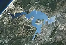 Overhead of dam and reservoir | |
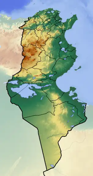 Location of Sidi El Barrak Dam in Tunisia | |
| Official name | Barrage Sidi El Barrak |
| Country | Tunisia |
| Coordinates | 37°01′29″N 08°56′11″E / 37.02472°N 8.93639°E |
| Construction began | 1994 |
| Opening date | 2000 |
| Dam and spillways | |
| Type of dam | Embankment |
| Impounds | Oued Zouara River |
| Height | 30 m (98 ft) |
| Length | 500 m (1,640 ft) |
| Dam volume | 2,700,000 m3 (3,531,467 cu yd) |
| Spillway capacity | 517 m3/s (18,258 cu ft/s) |
| Reservoir | |
| Total capacity | 264,000,000 m3 (214,028 acre⋅ft) |
| Official name | Barrage de Sidi El Barrak |
| Designated | 2 February 2012 |
| Reference no. | 2017[1] |
The Sidi El Barrak Dam is an embankment dam centred 18 km (11 mi) northeast of Tabarak and 2 km (1 mi) from the Mediterranean Sea on the Oued Zouara River in the Beja Governorate, Tunisia. Constructed between 1994 and 2000, the primary purpose of the dam is water supply.[2] As part of the Sidi el Barrak Development Project water stored in the dam is pumped to the Seyjame Dam, at a rate of 265,000,000 m3 (214,839 acre⋅ft) annually. This water is supplied to Tunis, Cap Bon and the Sahel including Sfax for municipal use along with other agricultural purposes. The entire project was completed in 2002.[3]
References
- ↑ "Barrage de Sidi El Barrak". Ramsar Sites Information Service. Retrieved 25 April 2018.
- ↑ "Sidi el Barrak". Hidrotehnika-Hidroenergetika. Retrieved 22 August 2011.
- ↑ "Sidi el Barrak Dam Completion Report" (PDF). African Development Bank. November 2002. Retrieved 22 August 2011.
This article is issued from Wikipedia. The text is licensed under Creative Commons - Attribution - Sharealike. Additional terms may apply for the media files.