Siegersdorf bei Herberstein | |
|---|---|
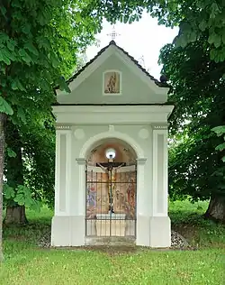 Chapel "Neuhold-Kreuz" in Siegersdorf | |
 Coat of arms | |
 Siegersdorf bei Herberstein Location within Austria | |
| Coordinates: 47°12′55″N 15°46′54″E / 47.21528°N 15.78167°E | |
| Country | Austria |
| State | Styria |
| District | Hartberg-Fürstenfeld |
| Government | |
| • Mayor | Maximilian Haas (ÖVP) |
| Area | |
| • Total | 4.97 km2 (1.92 sq mi) |
| Elevation | 560 m (1,840 ft) |
| Population (1 January 2016)[1] | |
| • Total | 287 |
| • Density | 58/km2 (150/sq mi) |
| Time zone | UTC+1 (CET) |
| • Summer (DST) | UTC+2 (CEST) |
| Postal code | 8222 |
| Area code | 03113 |
| Vehicle registration | HB |
| Website | www.siegersdorf-herberstein.at |
Siegersdorf bei Herberstein is a former municipality in the district of Hartberg-Fürstenfeld in Styria, Austria. Since 2015, it is part of the municipality Feistritztal.
References
- ↑ Statistik Austria - Bevölkerung zu Jahresbeginn 2002-2016 nach Gemeinden (Gebietsstand 1.1.2016) for Siegersdorf bei Herberstein.
This article is issued from Wikipedia. The text is licensed under Creative Commons - Attribution - Sharealike. Additional terms may apply for the media files.