Slat | |
|---|---|
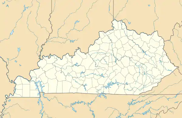 Slat Location within the state of Kentucky  Slat Slat (the United States) | |
| Coordinates: 36°48′36″N 84°54′33″W / 36.81000°N 84.90917°W | |
| Country | United States |
| State | Kentucky |
| County | Wayne |
| Elevation | 1,040 ft (320 m) |
| Time zone | UTC-5 (Eastern (EST)) |
| • Summer (DST) | UTC-4 (EST) |
| GNIS feature ID | 509074[1] |
Slat is an unincorporated community in Wayne County, Kentucky, United States. Its post office [2] is closed.
The origin of the name "Slat" is obscure.[3]
References
- ↑ U.S. Geological Survey Geographic Names Information System: Slat, Kentucky
- ↑ U.S. Geological Survey Geographic Names Information System: Slat KY post office
- ↑ Moyer, Armond; Moyer, Winifred (1958). The origins of unusual place-names. Keystone Pub. Associates. pp. 141–143.
Municipalities and communities of Wayne County, Kentucky, United States | ||
|---|---|---|
| City | 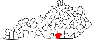 Location of Wayne County, Kentucky | |
| Unincorporated communities | ||
| Ghost town | ||
This article is issued from Wikipedia. The text is licensed under Creative Commons - Attribution - Sharealike. Additional terms may apply for the media files.