Spoy | |
|---|---|
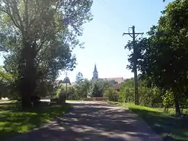 The road into Spoy | |
Location of Spoy | |
 Spoy  Spoy | |
| Coordinates: 47°26′48″N 5°11′27″E / 47.4467°N 5.1908°E | |
| Country | France |
| Region | Bourgogne-Franche-Comté |
| Department | Côte-d'Or |
| Arrondissement | Dijon |
| Canton | Is-sur-Tille |
| Government | |
| • Mayor (2020–2026) | Sébastien Chignardet[1] |
| Area 1 | 12.04 km2 (4.65 sq mi) |
| Population | 396 |
| • Density | 33/km2 (85/sq mi) |
| Time zone | UTC+01:00 (CET) |
| • Summer (DST) | UTC+02:00 (CEST) |
| INSEE/Postal code | 21614 /21120 |
| Elevation | 236–289 m (774–948 ft) (avg. 240 m or 790 ft) |
| 1 French Land Register data, which excludes lakes, ponds, glaciers > 1 km2 (0.386 sq mi or 247 acres) and river estuaries. | |
Spoy (French pronunciation: [spwa]) is a commune in the Côte-d'Or department in eastern France.
Population
| Year | Pop. | ±% |
|---|---|---|
| 1962 | 156 | — |
| 1968 | 182 | +16.7% |
| 1975 | 191 | +4.9% |
| 1982 | 228 | +19.4% |
| 1990 | 246 | +7.9% |
| 1999 | 244 | −0.8% |
| 2008 | 293 | +20.1% |
See also
References
- ↑ "Répertoire national des élus: les maires" (in French). data.gouv.fr, Plateforme ouverte des données publiques françaises. 13 September 2022.
- ↑ "Populations légales 2021". The National Institute of Statistics and Economic Studies. 28 December 2023.
Wikimedia Commons has media related to Spoy (Côte-d'Or).
This article is issued from Wikipedia. The text is licensed under Creative Commons - Attribution - Sharealike. Additional terms may apply for the media files.