| Stollgraben | |
|---|---|
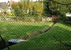 The Flösse in the village | |
| Location | |
| Country | Germany |
| State | Saxony-Anhalt |
| Region | Lower Harz |
| Municipality | Straßberg |
| Physical characteristics | |
| Source | |
| • location | Start: below Kiliansteich at the Rödelbach |
| • coordinates | 51°36′19″N 11°01′34″E / 51.605211°N 11.025982°E |
| • elevation | < 425 m above sea level (NN) |
| Mouth | |
• location | in Straßberg, at kilometre 56.0 into the Selke |
• coordinates | 51°37′05″N 11°03′05″E / 51.618166°N 11.051519°E |
• elevation | ca. 405 m (1,329 ft) |
| Length | 3.5 km (2.2 mi) [1] |
| Basin features | |
| Progression | Selke→ Bode→ Saale→ Elbe→ North Sea |
| Landmarks | Small towns: Harzgerode |
| Population | < 1,000 |
| Tributaries | |
| • right | Graben vom Glasebach, Glasebacher Zulaufgraben |
former function: Kunstgraben | |
The Stollgraben is an old artificial watercourse in Saxony-Anhalt, Germany.
See also
References
- ↑ Sachsen-Anhalt-Viewer, official topographic map; TK 1:10,000 colour, digital Orthophotos
This article is issued from Wikipedia. The text is licensed under Creative Commons - Attribution - Sharealike. Additional terms may apply for the media files.