| Stringer Brook | |
|---|---|
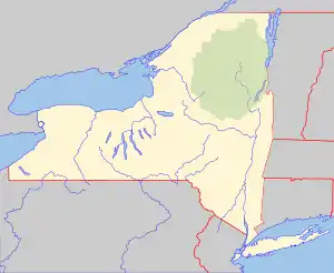 Location of the mouth within New York  Stringer Brook (the United States) | |
| Location | |
| Country | United States |
| State | New York |
| Region | Central New York |
| County | Oneida |
| Physical characteristics | |
| Source | |
| • location | West-southwest of Alder Creek |
| • coordinates | 43°24′03″N 75°16′44″W / 43.4009024°N 75.2787802°W[1] |
| Mouth | Mohawk River |
• location | North Western |
• coordinates | 43°20′36″N 75°22′09″W / 43.34333°N 75.36917°W[1] |
• elevation | 604 ft (184 m)[1] |
| Basin size | 12.9 sq mi (33 km2)[2] |
Stringer Brook is a river in Oneida County in the state of New York. It begins west-southwest of Alder Creek and flows into the Mohawk River in North Western.
References
- 1 2 3 "Stringer Brook". Geographic Names Information System. United States Geological Survey, United States Department of the Interior. Retrieved August 26, 2021.
- ↑ "Stringer Brook". usgs.gov. United States Geological Survey. Retrieved August 26, 2021.
This article is issued from Wikipedia. The text is licensed under Creative Commons - Attribution - Sharealike. Additional terms may apply for the media files.