Tabaruzaka Station 田原坂駅 | |
|---|---|
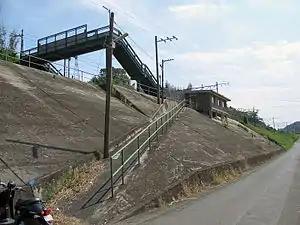 Tabaruzaka Station in 2006 | |
| General information | |
| Location | Japan |
| Coordinates | 32°53′59″N 130°39′12″E / 32.8996°N 130.6532°E |
| Operated by | |
| Line(s) | ■ Kagoshima Main Line, |
| Distance | 180.2 km from Mojikō |
| Platforms | 2 side platforms |
| Tracks | 2 |
| Construction | |
| Structure type | Side hill cutting |
| Accessible | No - platform accessed by footbridge, steep slope to station |
| Other information | |
| Status | Unstaffed |
| Website | Official website |
| History | |
| Opened | 1 October 1943 |
| Passengers | |
| FY2014 | 24 daily |
| Location | |
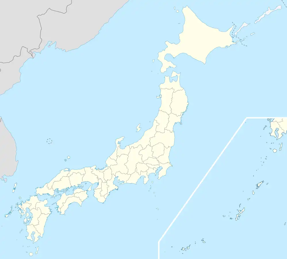 Tabaruzaka Station Location within Japan | |
Tabaruzaka Station (田原坂駅, Tabaruzaka-eki) is a railway station on the Kagoshima Main Line, operated by JR Kyushu in Kita-ku, Kumamoto, Japan.[1][2]
Lines
The station is served by the Kagoshima Main Line and is located 180.2 km from the starting point of the line at Mojiko.[3]
Layout
The station consists of two side platforms serving two tracks on a side hill cutting. A steep sloping ramp leads up to the station from the access road. The station building is a simple, functional, brick structure which is unstaffed and serves only as a waiting room. Access to the opposite side platform is by means of a footbridge.[2][3]
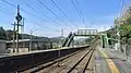 A view of the platforms and tracks.
 View from the station looking down onto the access road.
Adjacent stations
| ← | Service | → | ||
|---|---|---|---|---|
| Kagoshima Main Line | ||||
| Konoha | Local | Ueki | ||
| Konoha | Rapid | Ueki | ||
History
Japanese Government Railways (JGR) opened Tabaruzaka signal box on 1 October 1943 on the existing track of the Kagoshima Main Line. On 1 October 1965, Japanese National Railways (JNR) upgraded the facility to full station. With the privatization of JNR on 1 April 1987, JR Kyushu took over control of the station.[4]
Passenger statistics
In fiscal 2014, the station was used by an average of 24 passengers daily (boarding passengers only).[5]
References
- ↑ "JR Kyushu Route Map" (PDF). JR Kyushu. Retrieved 23 February 2018.
- 1 2 "田原坂" [Tabaruzaka]. hacchi-no-he.net. Retrieved 26 April 2018.
- 1 2 Kawashima, Ryōzō (2013). 図説: 日本の鉄道 四国・九州ライン 全線・全駅・全配線・第6巻 熊本 大分 エリア [Japan Railways Illustrated. Shikoku and Kyushu. All lines, all stations, all track layouts. Volume 6 Kumamoto Ōita Area] (in Japanese). Kodansha. pp. 20, 68. ISBN 9784062951654.
- ↑ Ishino, Tetsu; et al., eds. (1998). 停車場変遷大事典 国鉄・JR編 [Station Transition Directory – JNR/JR] (in Japanese). Vol. II. Tokyo: JTB Corporation. p. 683. ISBN 4-533-02980-9.
- ↑ "熊本地域公共交通網形成計画" [Kumamoto area public transport network plan]. Kumamoto City official website. 11 April 2016. Retrieved 3 April 2018. See Chapter 4: 公共交通の現状等 (Present situation of public transport)
External links
- Tabaruzaka (JR Kyushu)(in Japanese)