Tangier | |
|---|---|
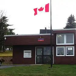 Tangier Post Office | |
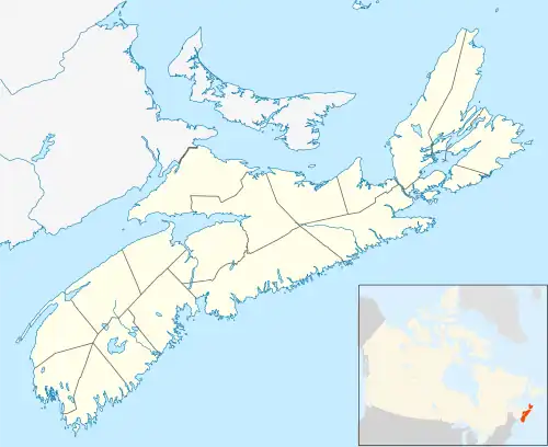 Tangier Location within Nova Scotia | |
| Coordinates: 44°47′59″N 62°42′0″W / 44.79972°N 62.70000°W | |
| Country | |
| Province | |
| Municipality | Halifax Regional Municipality |
| District | 2[1] |
| Government | |
| • Governing Council | Halifax Regional Council |
| Time zone | UTC-4 (AST) |
| • Summer (DST) | UTC-3 (ADT) |
| Canadian Postal code | B0J 3H0 |
| Telephone Exchange | 902 772 |
| GNBC Code | CBIKA[2] |
| Highways | |
| Part of a series about Places in Nova Scotia | |
Tangier is a rural community on the Eastern Shore of Nova Scotia, Canada, in the Halifax Regional Municipality. It lies along the Marine Drive on Nova Scotia Trunk 7 approximately 23 km (14 mi) west of Sheet Harbour. Tangier is situated at the head of Tangier Harbour.[2][3] The Mi'kmaq name for the settlement was Wospegeak, translating to "the sunshine is reflected from the water". The community is located at the mouth of Tangier River.[2][4] The present name of the community is most likely derived from the shipwreck of the schooner Tangier in 1830.[5][6] In 1858, gold was discovered in the area, which sparked gold mining operations in the area for the next 30 years.[6] The community has a church and several private fishing wharfs, as well as a post office.[7]
Places adjacent to Tangier, Nova Scotia | ||||||||||||||||
|---|---|---|---|---|---|---|---|---|---|---|---|---|---|---|---|---|
| ||||||||||||||||
References
Citations
- ↑ "Current Polling District Boundaries". Halifax Regional Municipality. Retrieved 24 December 2018.
- 1 2 3 "Tangier". Natural Resources Canada. Retrieved 24 December 2018.
- ↑ "Tangier Harbour". Natural Resources Canada. Retrieved 24 December 2018.
- ↑ "Tangier River". Natural Resources Canada. Retrieved 28 December 2018.
- ↑ Hamiton, William Baillie (1996). Place Names of Atlantic Canada (illustrated, reprint ed.). University of Toronto Press. p. 407. ISBN 9780802075703. Retrieved 19 September 2017.
- 1 2 Scott 2011, p. 251.
- ↑ "Find a Post Office". Canada Post. Retrieved 28 December 2018.
Bibliography
Scott, David (2011). Nova Scotia Place Names. DESPUB. ISBN 978-0-9865370-1-1.