| Theel | |
|---|---|
 | |
| Location | |
| Country | Germany |
| State | Saarland |
| Physical characteristics | |
| Mouth | |
• location | Prims |
• coordinates | 49°23′37″N 6°51′00″E / 49.3937°N 6.8501°E |
| Basin features | |
| Progression | Prims→ Saar→ Moselle→ Rhine→ North Sea |
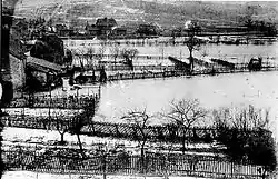
Theel is a river of Saarland, Germany. It is 25.4km long[1] and flows into the Prims near Lebach.
See also
References
- ↑ "Geoportal SL". geoportal.saarland.de. Retrieved 2023-01-12.
This article is issued from Wikipedia. The text is licensed under Creative Commons - Attribution - Sharealike. Additional terms may apply for the media files.