Treaty Four Reserve Grounds 77 | |
|---|---|
| Treaty Four Reserve Grounds Indian Reserve No. 77 | |
 Flag | |
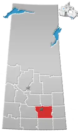
 Location in Saskatchewan | |
| First Nation | Held collectively |
| Country | Canada |
| Province | Saskatchewan |
| Area | |
| • Total | 99.2 ha (245.1 acres) |
| Population (2016)[2] | |
| • Total | 15 |
| • Density | 15/km2 (39/sq mi) |
The Treaty Four Reserve Grounds 77 are an Indian reserve in Saskatchewan, Canada, shared by 33 band governments from Saskatchewan and Manitoba.[1][3] The Reserve Grounds are located adjacent to and west of Fort Qu'Appelle. In the 2016 Canadian Census, they recorded a population of 15 living in 6 of their 8 total private dwellings.[2]
All bands are signatories to Treaty 4. This Reserve may belong to Assiniboine Chief Long Lodge #77, who was a treaty signatory chief to Treaty 4 in 1877 at Cypress Hills. Further this land was designated to be shared by all Treaty 4 bands in 1996 to commemorate the signing of the Treaty Land Entitlement agreements between First Nation and the Provincial and Federal Governments. It was given the #77 after this.
List of bands sharing the reserve
- Carry the Kettle Nakoda First Nation
- Coté First Nation
- Cowessess First Nation
- Day Star First Nation
- Fishing Lake First Nation
- Gambler First Nation
- George Gordon First Nation
- Kahkewistahaw First Nation
- Kawacatoose First Nation
- Keeseekoose First Nation
- Kinistin Saulteaux Nation
- Little Black Bear First Nation
- Muscowpetung Saulteaux Nation
- Muskowekwan First Nation
- Nekaneet Cree Nation
- Ocean Man First Nation
- Ochapowace Nation
- Okanese First Nation
- Pasqua First Nation
- Peepeekisis Cree Nation
- Pheasant Rump Nakota First Nation
- Piapot First Nation
- Pine Creek First Nation
- Rolling River First Nation
- Sapotaweyak Cree Nation
- Star Blanket Cree Nation
- The Key First Nation
- Tootinaowaziibeeng Treaty Reserve
- Waywayseecappo First Nation
- White Bear First Nations
- Wuskwi Sipihk First Nation
- Yellow Quill First Nation
- Zagime Anishinabek
See also
References
- 1 2 "Reserve/Settlement/Village Detail". Crown–Indigenous Relations and Northern Affairs Canada. Government of Canada. Retrieved 12 August 2019.
- 1 2 "Census Profile, 2016 Census". Statistics Canada. 8 February 2017. Retrieved 10 August 2019.
- ↑ "Canada Lands Survey System - CLSS Map Browser". Natural Resources Canada. Retrieved 9 October 2019.
50°45′37″N 103°47′02″W / 50.7603°N 103.7839°W