Union Township | |
|---|---|
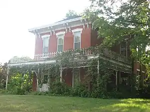 The James Culbertson Reynolds House in Monticello | |
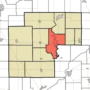 Location in White County | |
| Coordinates: 40°44′55″N 86°46′14″W / 40.74861°N 86.77056°W | |
| Country | United States |
| State | Indiana |
| County | White |
| Government | |
| • Type | Indiana township |
| Area | |
| • Total | 43.81 sq mi (113.5 km2) |
| • Land | 41.67 sq mi (107.9 km2) |
| • Water | 2.14 sq mi (5.5 km2) 4.88% |
| Elevation | 679 ft (207 m) |
| Population (2010) | |
| • Total | 9,906 |
| • Density | 237.7/sq mi (91.8/km2) |
| ZIP codes | 47929, 47960 |
| GNIS feature ID | 453939 |
Union Township is one of twelve townships in White County, Indiana, United States. As of the 2010 census, its population was 9,906 and it contained 4,989 housing units.[1]
Union Township was organized in 1834.[2]
Geography
According to the 2010 census, the township has a total area of 43.81 square miles (113.5 km2), of which 41.67 square miles (107.9 km2) (or 95.12%) is land and 2.14 square miles (5.5 km2) (or 4.88%) is water.[1]
Cities, towns, villages
Unincorporated towns
- Cedar Point at 40°42′32″N 86°45′37″W / 40.708928°N 86.760289°W
- East Monticello at 40°44′46″N 86°45′12″W / 40.746150°N 86.753345°W
- Golden Hill at 40°42′37″N 86°45′38″W / 40.710316°N 86.760567°W
- Guernsey at 40°48′01″N 86°48′46″W / 40.800317°N 86.812791°W
- Indiana Beach at 40°47′29″N 86°46′05″W / 40.791428°N 86.768068°W
(This list is based on USGS data and may include former settlements.)
Adjacent townships
- Liberty Township (north)
- Lincoln Township (east)
- Jefferson Township, Carroll County (southeast)
- Big Creek Township (southwest)
- Honey Creek Township (west)
- Monon Township (northwest)
Cemeteries
The township contains these two cemeteries: Cutler and River View.
Airports and landing strips
- Dittman Airport
- White County Airport
Rivers
Landmarks
- Monticello City Park
- The White County Asylum was listed on the National Register of Historic Places in 2010.[3]
Education
- Twin Lakes School Corporation
Union Township is served by the Monticello-Union Township Public Library.[4]
Political districts
- Indiana's 4th congressional district
- State House District 15
- State House District 16
- State Senate District 07
References
- United States Census Bureau 2007 TIGER/Line Shapefiles
- United States Board on Geographic Names (GNIS)
- IndianaMap
- 1 2 "Population, Housing Units, Area, and Density: 2010 - County -- County Subdivision and Place -- 2010 Census Summary File 1". United States Census. Archived from the original on February 12, 2020. Retrieved May 10, 2013.
- ↑ Hamelle, W. H. (1915). A Standard History of White County, Indiana: An Authentic Narrative of the Past, with an Extended Survey of Modern Developments in the Progress of Town and Country. Unigraphic. p. 191.
- ↑ "National Register of Historic Places Listings". Weekly List of Actions Taken on Properties: 9/20/10 through 9/24/10. National Park Service. October 1, 2010.
- ↑ "Indiana public library directory" (PDF). Indiana State Library. Retrieved March 15, 2018.
External links
Municipalities and communities of White County, Indiana, United States | ||
|---|---|---|
| City | Map of Indiana highlighting White County | |
| Towns | ||
| Townships | ||
| CDPs | ||
| Other unincorporated communities | ||
This article is issued from Wikipedia. The text is licensed under Creative Commons - Attribution - Sharealike. Additional terms may apply for the media files.