Värska Parish
Värska vald | |
|---|---|
 Mustoja Landscape Conservation Area | |
 Coat of arms | |
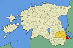 Värska Parish within Põlva County. | |
| Country | |
| County | |
| Administrative centre | Värska |
| Area | |
| • Total | 187.82 km2 (72.52 sq mi) |
| Population (01.01.2009) | |
| • Total | 1,344 |
| • Density | 7.2/km2 (19/sq mi) |
| Website | www.verska.ee |
Värska Parish (Estonian: Värska vald) was a rural municipality of Estonia, in Põlva County. It had a population of 1,344 (as of 1 January 2009) and an area of 187.82 km2 (72.52 sq mi).[1]
Settlements
- Small borough
- Villages
Koidula • Kolodavitsa • Kolossova • Korela • Kostkova • Kremessova • Kundruse • Litvina • Lobotka • Lutepää • Määsovitsa • Matsuri • Nedsaja • Õrsava • Pattina • Perdaku • Podmotsa • Popovitsa • Rääptsova • Saabolda • Saatse • Samarina • Säpina • Sesniki • Tonja • Treski • Ulitina • Vaartsi • Väike-Rõsna • Vedernika • Velna • Verhulitsa • Võpolsova • Voropi
Gallery
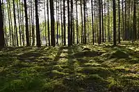
 Mustoja Landscape Conservation Area is the biggest protected area in Põlva County
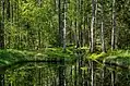
 Poogandi Lake in Mustoja Nature Reserve
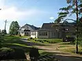 Hirvemäe Holiday Centre
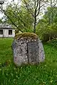 Memorial stone in Säpina village
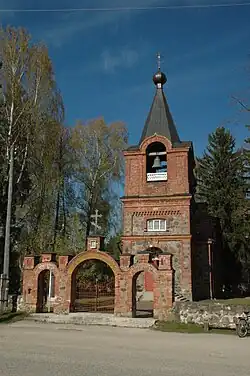 Värska Orthodox Church
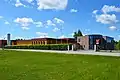 Värska Vesi AS company which produces mineral water
See also
References
- ↑ "Population figure and composition". Statistics Estonia. Retrieved 27 January 2010.
External links
- Official website (in Estonian)
57°57′28″N 27°37′59″E / 57.95778°N 27.63306°E
| Rural municipalities | ||
|---|---|---|
This article is issued from Wikipedia. The text is licensed under Creative Commons - Attribution - Sharealike. Additional terms may apply for the media files.