Van Buren Township | |
|---|---|
 Township hall, located in Stanford | |
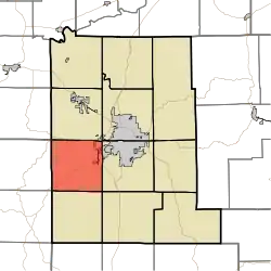 Location in Monroe County | |
| Coordinates: 39°07′23″N 86°37′58″W / 39.12306°N 86.63278°W | |
| Country | |
| State | |
| County | Monroe |
| Government | |
| • Type | Indiana township |
| Area | |
| • Total | 34.85 sq mi (90.3 km2) |
| • Land | 34.85 sq mi (90.3 km2) |
| • Water | 0 sq mi (0 km2) 0% |
| Elevation | 820 ft (250 m) |
| Population (2010) | |
| • Total | 11,981 |
| • Density | 343.8/sq mi (132.7/km2) |
| Time zone | UTC-5 (Eastern (EST)) |
| • Summer (DST) | UTC-4 (EDT) |
| ZIP codes | 47403, 47404 |
| Area code(s) | 812, 930 |
| GNIS feature ID | 453950 |
Van Buren Township is one of eleven townships in Monroe County, Indiana, United States. As of the 2010 census, its population was 11,981 and it contained 5,347 housing units.[2]
History
Van Buren Township was established in 1837.[3]
Geography
According to the 2010 census, the township has a total area of 34.85 square miles (90.3 km2), all land.[2]
Cities, towns, villages
- Bloomington (west edge)
Unincorporated towns
- Elwren at 39°06′31″N 86°40′11″W / 39.108658°N 86.669723°W
- Garden Acres at 39°07′28″N 86°34′41″W / 39.124492°N 86.578054°W
- Highland Village at 39°09′39″N 86°35′01″W / 39.160880°N 86.58361°W
- Kirby at 39°08′12″N 86°36′36″W / 39.136714°N 86.609999°W
- Leonard Springs at 39°08′26″N 86°34′38″W / 39.140603°N 86.577221°W
- Stanford at 39°05′23″N 86°40′00″W / 39.089769°N 86.666668°W
(This list is based on USGS data and may include former settlements.)
Cemeteries
The township contains these two cemeteries: Harmony and Keller.
Major highways
Airports and landing strips
School districts
- Monroe County Community School Corporation
Political districts
- Indiana's 4th congressional district
- State House District 60
- State Senate District 40
References
- "Van Buren Township, Monroe County, Indiana". Geographic Names Information System. United States Geological Survey, United States Department of the Interior. Retrieved September 27, 2009.
- United States Census Bureau 2008 TIGER/Line Shapefiles
- IndianaMap
- ↑ "US Board on Geographic Names". United States Geological Survey. October 25, 2007. Retrieved May 9, 2017.
- 1 2 "Population, Housing Units, Area, and Density: 2010 - County -- County Subdivision and Place -- 2010 Census Summary File 1". United States Census. Archived from the original on February 12, 2020. Retrieved May 10, 2013.
- ↑ Blanchard, Charles (1884). Counties of Morgan, Monroe and Brown, Indiana: Historical and Biographical. F.A. Battey & Company. pp. 381.
External links
Places adjacent to Van Buren Township, Monroe County, Indiana | |
|---|---|
Municipalities and communities of Monroe County, Indiana, United States | ||
|---|---|---|
| City | Map of Indiana highlighting Monroe County | |
| Towns | ||
| Townships | ||
| CDPs | ||
| Other communities | ||
This article is issued from Wikipedia. The text is licensed under Creative Commons - Attribution - Sharealike. Additional terms may apply for the media files.