Verdes | |
|---|---|
Part of Beauce la Romaine | |
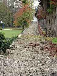 The Roman road known as Julius Caesar Way, in Verdes | |
.svg.png.webp) Coat of arms | |
Location of Verdes | |
 Verdes  Verdes | |
| Coordinates: 47°57′32″N 1°25′48″E / 47.9589°N 1.43°E | |
| Country | France |
| Region | Centre-Val de Loire |
| Department | Loir-et-Cher |
| Arrondissement | Blois |
| Canton | La Beauce |
| Commune | Beauce la Romaine |
| Area 1 | 28.59 km2 (11.04 sq mi) |
| Population (2019)[1] | 429 |
| • Density | 15/km2 (39/sq mi) |
| Time zone | UTC+01:00 (CET) |
| • Summer (DST) | UTC+02:00 (CEST) |
| Postal code | 41240 |
| Elevation | 107–132 m (351–433 ft) (avg. 125 m or 410 ft) |
| 1 French Land Register data, which excludes lakes, ponds, glaciers > 1 km2 (0.386 sq mi or 247 acres) and river estuaries. | |
Verdes (French pronunciation: [vɛʁd]) is a former commune in the Loir-et-Cher department in central France. On 1 January 2016, it was merged into the new commune of Beauce la Romaine.[2] Its population was 429 in 2019.[1]
See also
References
Wikimedia Commons has media related to Verdes.
This article is issued from Wikipedia. The text is licensed under Creative Commons - Attribution - Sharealike. Additional terms may apply for the media files.