Villalonga/Vilallonga
Villalonga | |
|---|---|
 | |
 Coat of arms | |
 Villalonga/Vilallonga Location in Spain | |
| Coordinates: 38°53′5″N 0°12′31″W / 38.88472°N 0.20861°W | |
| Country | |
| Autonomous community | |
| Province | Valencia |
| Comarca | Safor |
| Judicial district | Gandia |
| Government | |
| • Alcalde | Juan Bautista Ros Pavía-PP |
| Area | |
| • Total | 43.3 km2 (16.7 sq mi) |
| Elevation | 92 m (302 ft) |
| Population (2018)[1] | |
| • Total | 4,303 |
| • Density | 99/km2 (260/sq mi) |
| Demonym(s) | Villalonguero/a Villalonguer/a |
| Time zone | UTC+1 (CET) |
| • Summer (DST) | UTC+2 (CEST) |
| Postal code | 46720 |
| Official language(s) | Valencian and Spanish |
| Website | Official website |
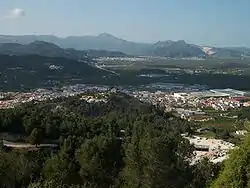
Villalonga (Spanish: [biʎaˈloŋɡa]) or Vilallonga (Valencian: [ˌvilaˈʎoŋɡa]) (officially Villalonga/Vilallonga) is a municipality in the comarca of Safor in the Valencian Community, Spain.
References
- ↑ Municipal Register of Spain 2018. National Statistics Institute.

This article is issued from Wikipedia. The text is licensed under Creative Commons - Attribution - Sharealike. Additional terms may apply for the media files.