Ville-di-Pietrabugno | |
|---|---|
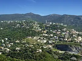 The church of Santa Lucia and the surrounding buildings, in Ville-di-Pietrabugno | |
Location of Ville-di-Pietrabugno | |
 Ville-di-Pietrabugno  Ville-di-Pietrabugno | |
| Coordinates: 42°42′51″N 9°25′54″E / 42.7142°N 9.4317°E | |
| Country | France |
| Region | Corsica |
| Department | Haute-Corse |
| Arrondissement | Bastia |
| Canton | Bastia-1 |
| Intercommunality | CA Bastia |
| Government | |
| • Mayor (2020–2026) | Michel Rossi[1] |
| Area 1 | 7.53 km2 (2.91 sq mi) |
| Population | 3,232 |
| • Density | 430/km2 (1,100/sq mi) |
| Time zone | UTC+01:00 (CET) |
| • Summer (DST) | UTC+02:00 (CEST) |
| INSEE/Postal code | 2B353 /20200 |
| Elevation | 0–900 m (0–2,953 ft) (avg. 339 m or 1,112 ft) |
| 1 French Land Register data, which excludes lakes, ponds, glaciers > 1 km2 (0.386 sq mi or 247 acres) and river estuaries. | |
Ville-di-Pietrabugno (French pronunciation: [vile di pjɛtʁabuɲo]; Corsican: E Ville di Petrabugnu) is a commune in the Haute-Corse department of France on the island of Corsica.
Population
| Year | Pop. | ±% p.a. |
|---|---|---|
| 1968 | 1,562 | — |
| 1975 | 1,735 | +1.51% |
| 1982 | 2,827 | +7.22% |
| 1990 | 2,950 | +0.53% |
| 1999 | 2,950 | +0.00% |
| 2007 | 3,075 | +0.52% |
| 2012 | 3,559 | +2.97% |
| 2017 | 3,323 | −1.36% |
| Source: INSEE[3] | ||
See also
References
- ↑ "Répertoire national des élus: les maires". data.gouv.fr, Plateforme ouverte des données publiques françaises (in French). 2 December 2020.
- ↑ "Populations légales 2021". The National Institute of Statistics and Economic Studies. 28 December 2023.
- ↑ Population en historique depuis 1968, INSEE
Wikimedia Commons has media related to Ville-di-Pietrabugno.
This article is issued from Wikipedia. The text is licensed under Creative Commons - Attribution - Sharealike. Additional terms may apply for the media files.