| Vysun | |
|---|---|
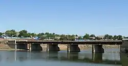 The Vysun at Volodymyrivka | |
| Location | |
| Country | Ukraine |
| Physical characteristics | |
| Mouth | Inhulets |
• coordinates | 47°06′52″N 32°53′45″E / 47.1144°N 32.8959°E |
| Length | 201 km (125 mi) |
| Basin size | 2,670 km2 (1,030 sq mi) |
| Basin features | |
| Progression | Inhulets→ Dnieper→ Dnieper–Bug estuary→ Black Sea |
The Vysun, Vulsun or Isun (Ukrainian: Висунь) is a river of Ukraine, flowing through the Mykolaiv Oblast. It is a right tributary of the Inhulets. It has a length of 201 km and begins in the Dnieper Upland and flows south through Prychornomorskoy Lowland, through the district center of Kazanka. It covers a basin of 2670 km2. During season it is powered mainly by snowmelt.[1][2]
References
- ↑ Висунь, Great Soviet Encyclopedia
- ↑ "NÉVJEGYZÉK-SZÓTÁR az UKRAJNA TERMÉSZETI FÖLDRAJZA tantárgyhoz" (pdf) (in Hungarian). II. Rákóczi Ferenc Kárpátaljai Magyar Főiskola. Retrieved 2019-05-10.
This article is issued from Wikipedia. The text is licensed under Creative Commons - Attribution - Sharealike. Additional terms may apply for the media files.