Waisenegg | |
|---|---|
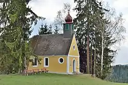 Chapel in Waisenegg | |
 Coat of arms | |
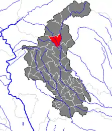 Location within Weiz district | |
 Waisenegg Location within Austria | |
| Coordinates: 47°23′39″N 15°41′02″E / 47.39417°N 15.68389°E | |
| Country | Austria |
| State | Styria |
| District | Weiz |
| Government | |
| • Mayor | Franz Tiefengraber (ÖVP) |
| Area | |
| • Total | 26.04 km2 (10.05 sq mi) |
| Elevation | 747 m (2,451 ft) |
| Population (1 January 2016)[1] | |
| • Total | 1,065 |
| • Density | 41/km2 (110/sq mi) |
| Time zone | UTC+1 (CET) |
| • Summer (DST) | UTC+2 (CEST) |
| Postal code | 8190 |
| Area code | 03174 |
| Vehicle registration | WZ |
| Website | www.waisenegg.at |
Waisenegg is a former municipality in the district of Weiz in the Austrian state of Styria. Since the 2015 Styria municipal structural reform, it is part of the municipality Birkfeld.[2]
References
This article is issued from Wikipedia. The text is licensed under Creative Commons - Attribution - Sharealike. Additional terms may apply for the media files.