| Warooka South Australia | |||||||||||||||
|---|---|---|---|---|---|---|---|---|---|---|---|---|---|---|---|
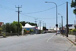 Main street | |||||||||||||||
 Warooka | |||||||||||||||
| Coordinates | 34°59′24″S 137°23′56″E / 34.99000°S 137.39889°E | ||||||||||||||
| Population | 194 (UCL 2021)[1] | ||||||||||||||
| Postcode(s) | 5577 | ||||||||||||||
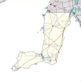
| Location | |||||||||||||||
| LGA(s) | Yorke Peninsula Council | ||||||||||||||
| State electorate(s) | Narungga[2] | ||||||||||||||
| Federal division(s) | Grey[3] | ||||||||||||||
| |||||||||||||||
Warooka is a town on the Yorke Peninsula in South Australia, known as the 'Gateway to the bottom end'.[5]
See also
References
- ↑ Australian Bureau of Statistics (28 June 2022). "Warooka (urban centre and locality)". Australian Census 2021.
- ↑ Narungga (Map). Electoral District Boundaries Commission. 2016. Retrieved 1 March 2018.
- ↑ "Federal electoral division of Grey" (PDF). Australian Electoral Commission. Retrieved 24 July 2015.
- 1 2 3 4 5 6 7 8 "New Ward Structure 2014". Yorke Peninsula Council. Retrieved 21 October 2015.
- ↑ "2905.0 – Statistical Geography: Volume 2 -- Census Geographic Areas, Australia, 2006". Australian Bureau of Statistics. Retrieved 8 December 2009.
External links
![]() Media related to Warooka, South Australia at Wikimedia Commons
Media related to Warooka, South Australia at Wikimedia Commons
| Major Townships | |||||||
|---|---|---|---|---|---|---|---|
| Minor Townships | |||||||
| Governance |
| ||||||
| Coastal features | |||||||
| Protected areas |
| ||||||
| Adjacent islands | |||||||
| Related and uncategorised | |||||||
| |||||||
This article is issued from Wikipedia. The text is licensed under Creative Commons - Attribution - Sharealike. Additional terms may apply for the media files.