Weng im Innkreis | |
|---|---|
 | |
 Coat of arms | |
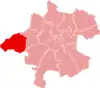
 Weng im Innkreis Location within Austria | |
| Coordinates: 48°14′09″N 13°10′47″E / 48.23583°N 13.17972°E | |
| Country | Austria |
| State | Upper Austria |
| District | Braunau am Inn |
| Government | |
| • Mayor | Josef Moser (ÖVP) |
| Area | |
| • Total | 21.36 km2 (8.25 sq mi) |
| Elevation | 370 m (1,210 ft) |
| Population (2018-01-01)[2] | |
| • Total | 1,394 |
| • Density | 65/km2 (170/sq mi) |
| Time zone | UTC+1 (CET) |
| • Summer (DST) | UTC+2 (CEST) |
| Postal code | 4952 (Weng im Innkreis), 4950 (Altheim), 4961 (Mühlheim am Inn) |
| Area code | 07723 |
| Vehicle registration | BR |
| Website | www.weng-innkreis.at |
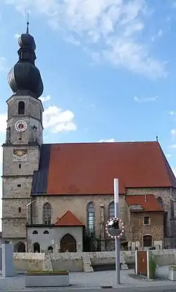
Weng im Innkreis is a municipality in the district of Braunau am Inn in the Austrian state of Upper Austria.
Geography
Weng lies on the western edge of the Innviertel hills. About 8 percent of the municipality is forest and 83 percent farmland.
Places adjacent to Weng im Innkreis | ||||||||||||||||
|---|---|---|---|---|---|---|---|---|---|---|---|---|---|---|---|---|
| ||||||||||||||||
References
- ↑ "Dauersiedlungsraum der Gemeinden Politischen Bezirke und Bundesländer - Gebietsstand 1.1.2018". Statistics Austria. Retrieved 10 March 2019.
- ↑ "Einwohnerzahl 1.1.2018 nach Gemeinden mit Status, Gebietsstand 1.1.2018". Statistics Austria. Retrieved 9 March 2019.
Wikimedia Commons has media related to Weng im Innkreis.
This article is issued from Wikipedia. The text is licensed under Creative Commons - Attribution - Sharealike. Additional terms may apply for the media files.